
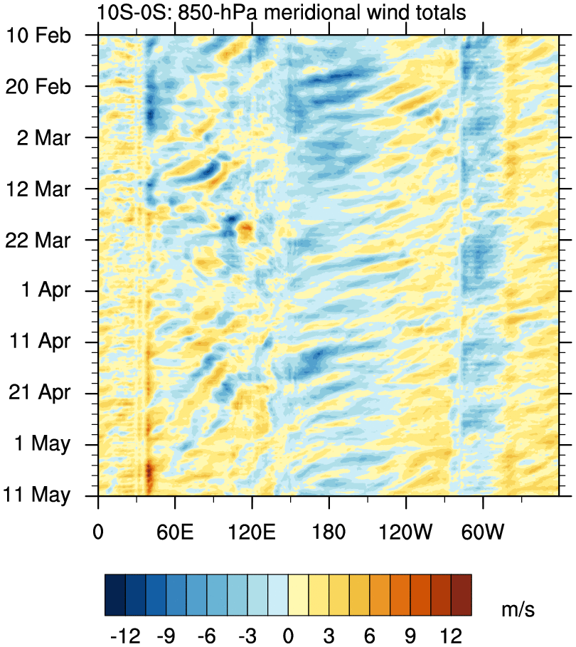
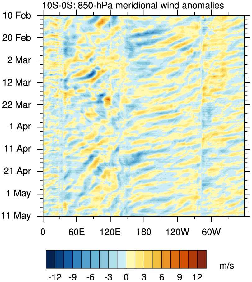
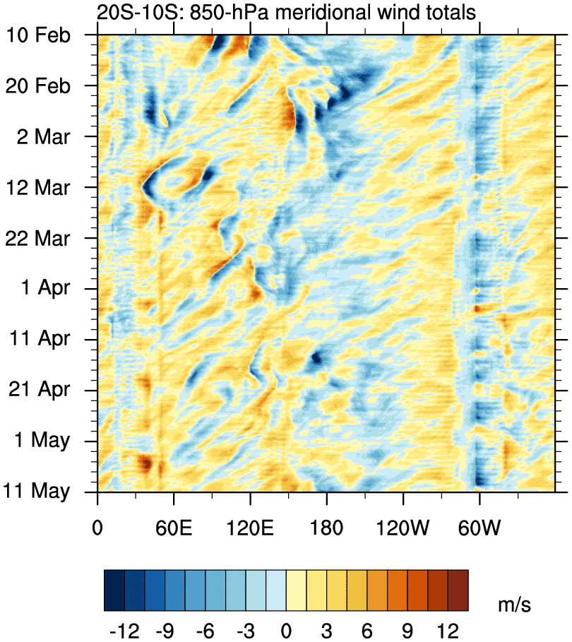
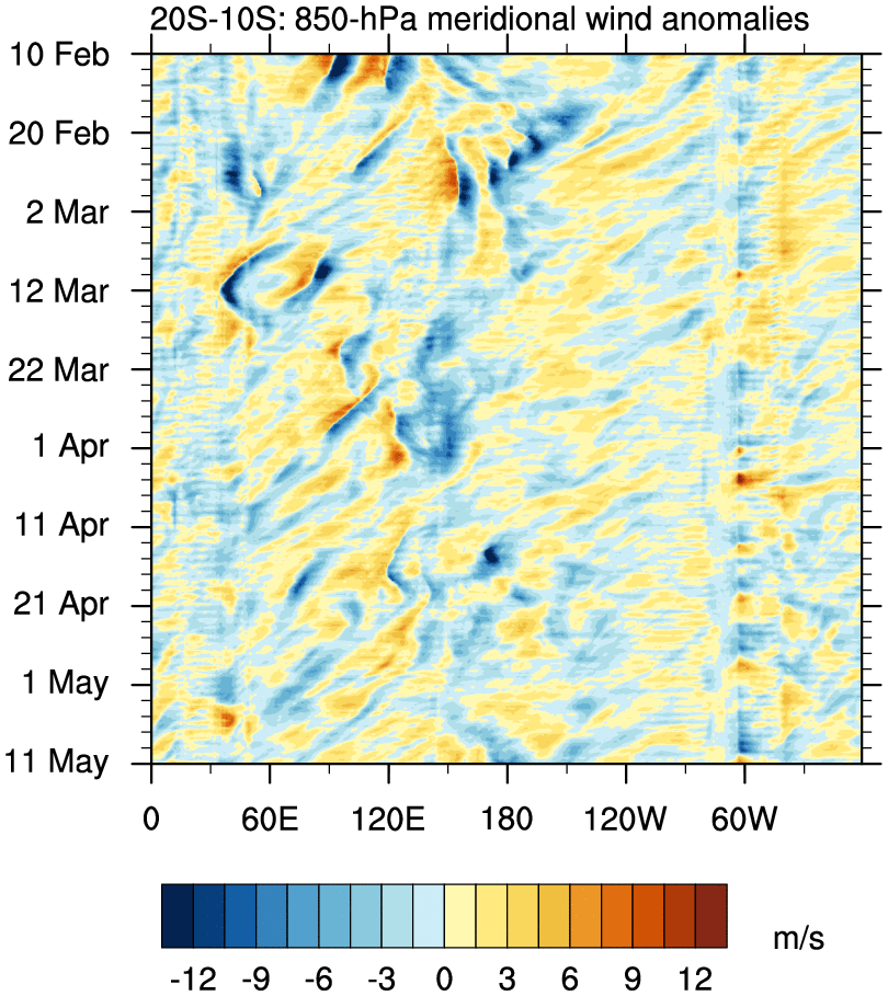
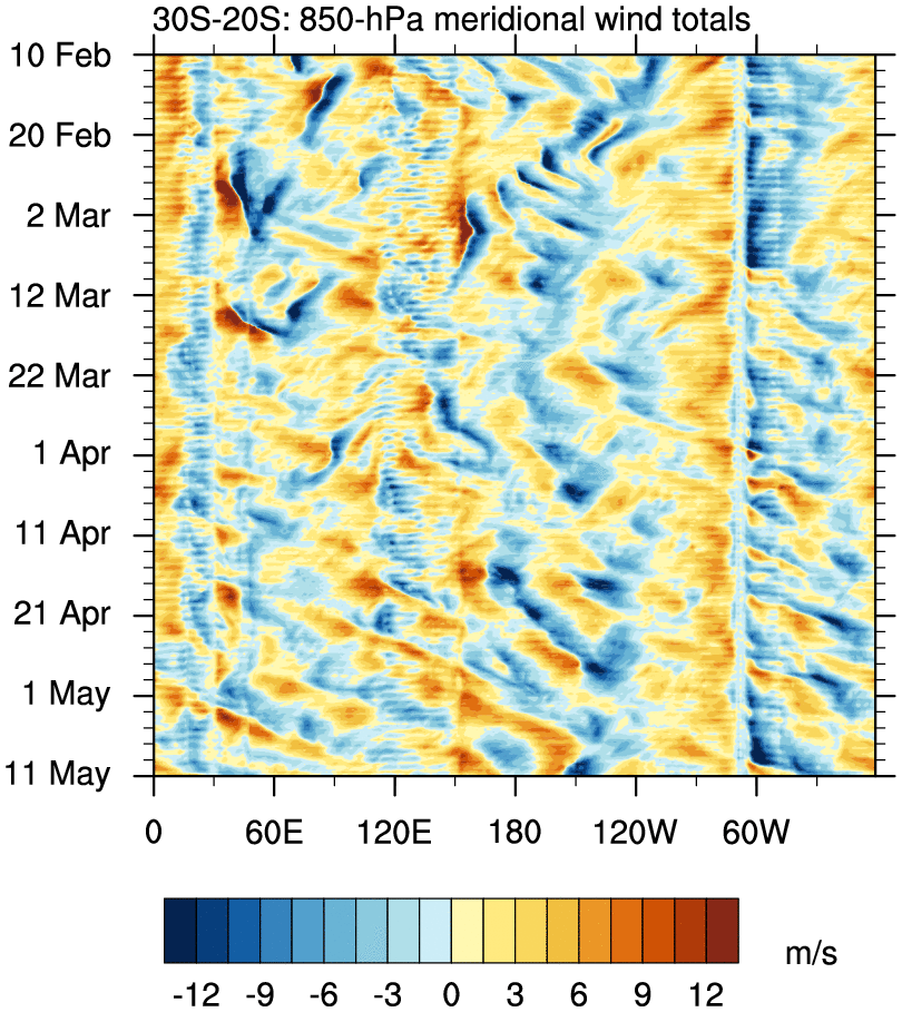
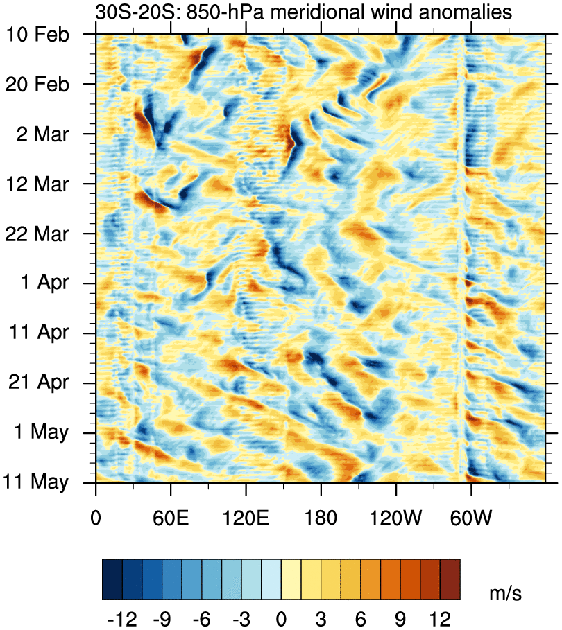
Global Time–Longitude Plots
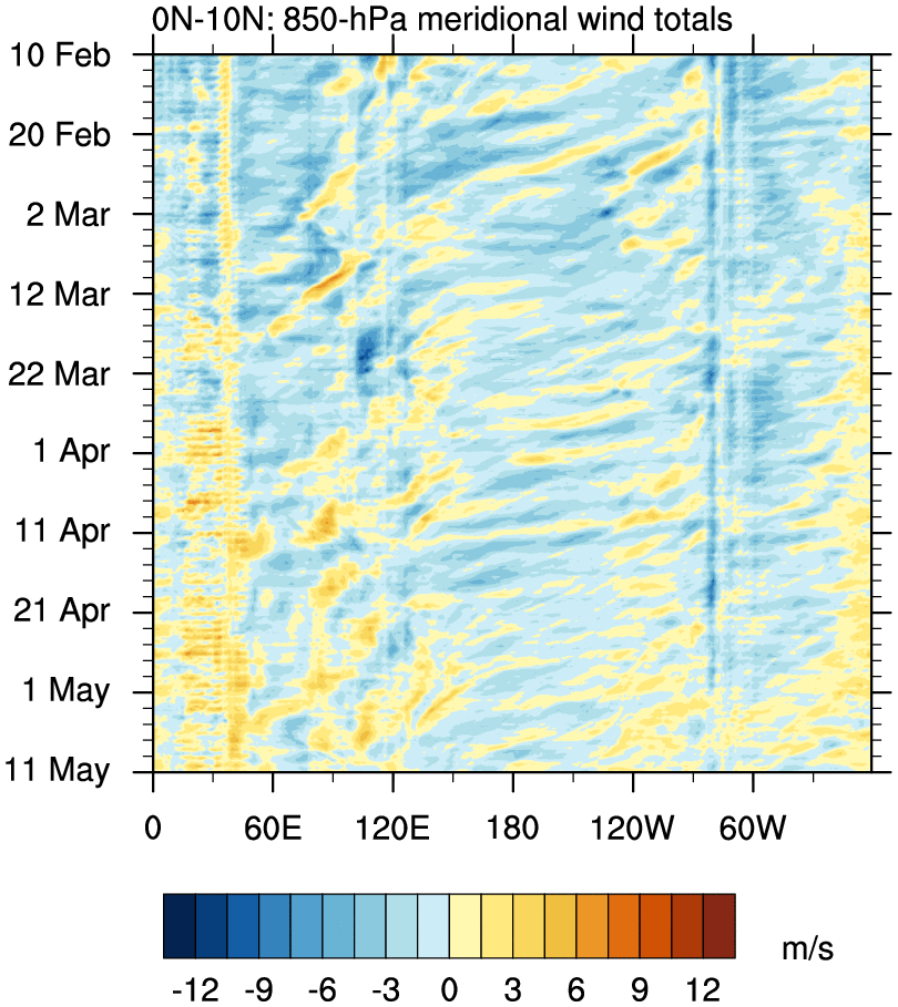
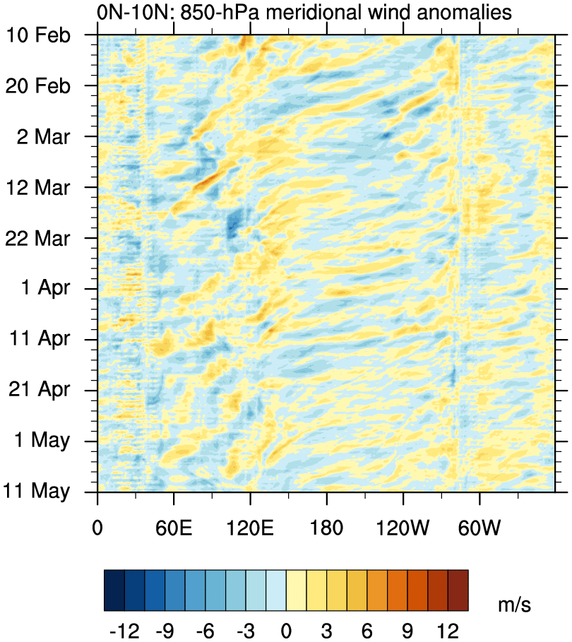
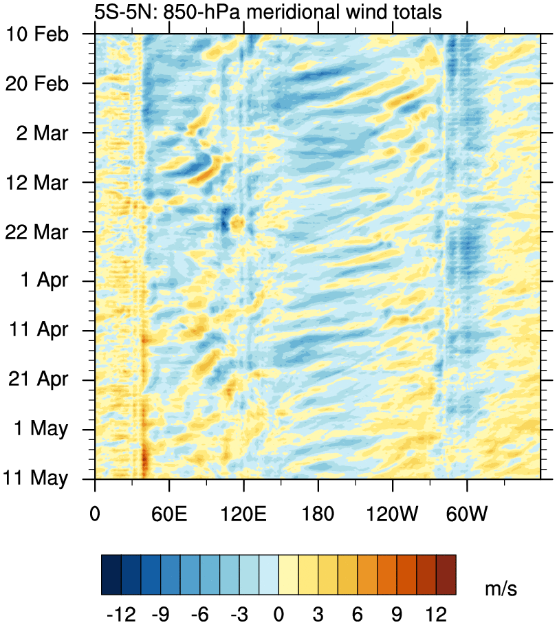
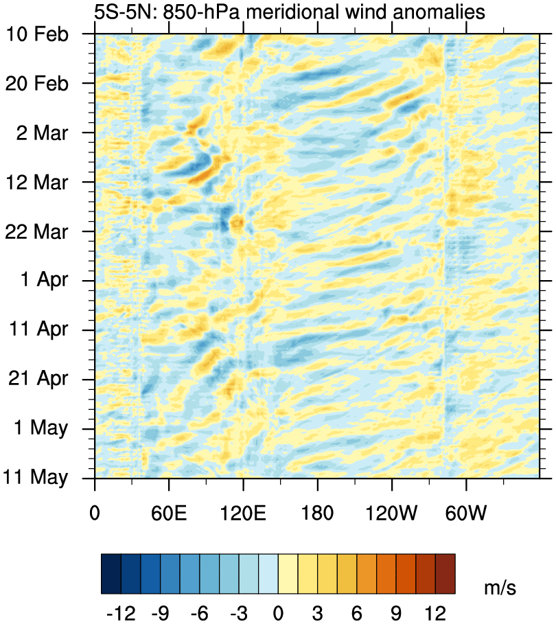
o Time–longitude plots of rainfall and winds, averaged over the indicated 10° latitude bands.
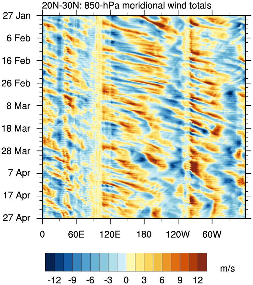
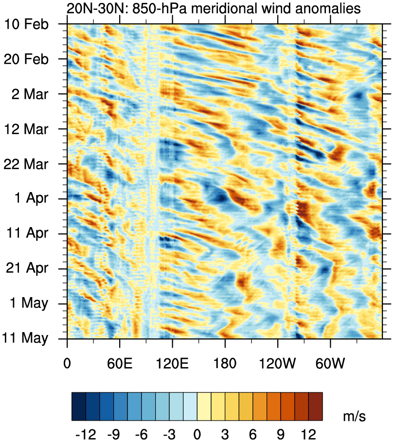
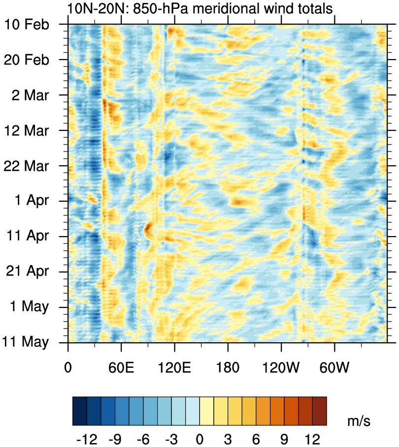
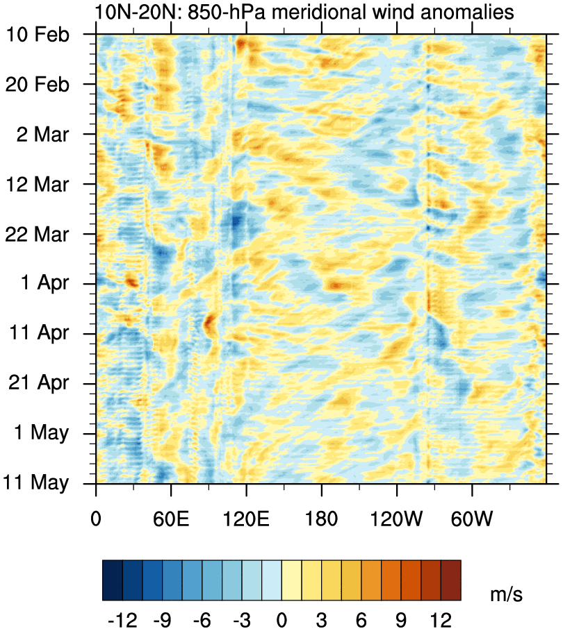
o Wind plots use 1° GFS analyses for the last 90 days
o Updated daily at 1200 UTC
850 hPa Meridional Wind
20°N – 30°N total anom
10°N – 20°N total anom
Eq – 10°N total anom
5°S – 5°N total anom
10°S – Eq total anom
20°S – 10°S total anom
30°S – 20°S total anom
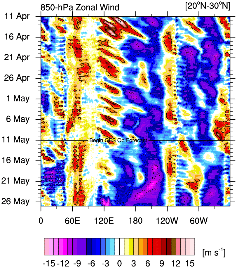
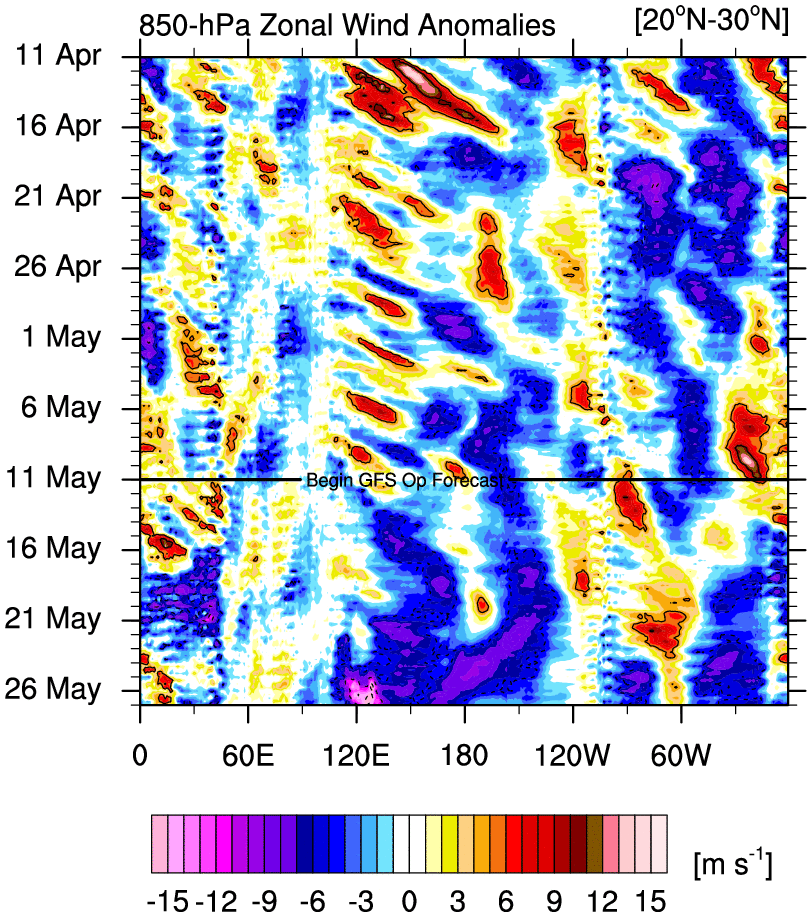
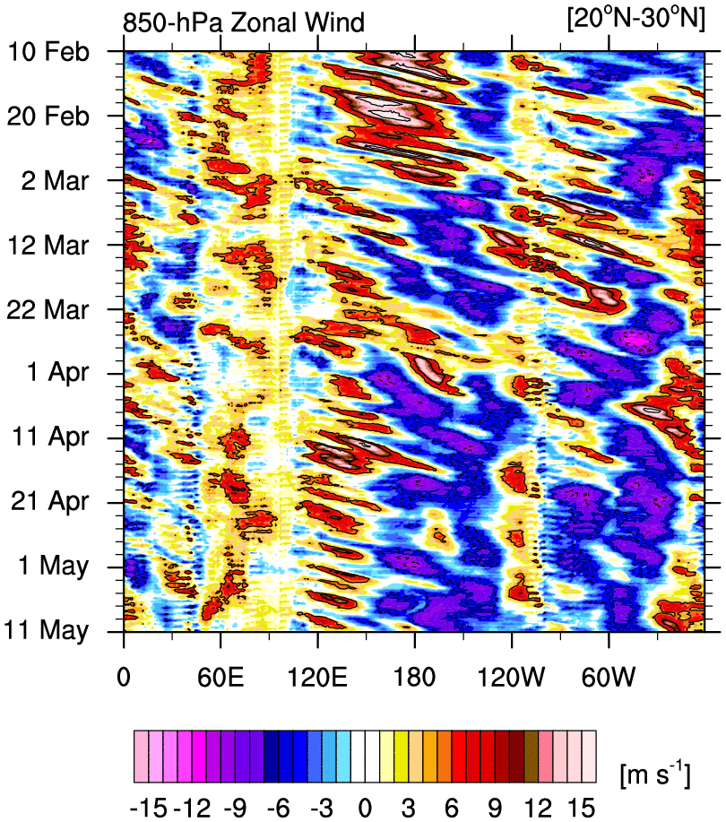
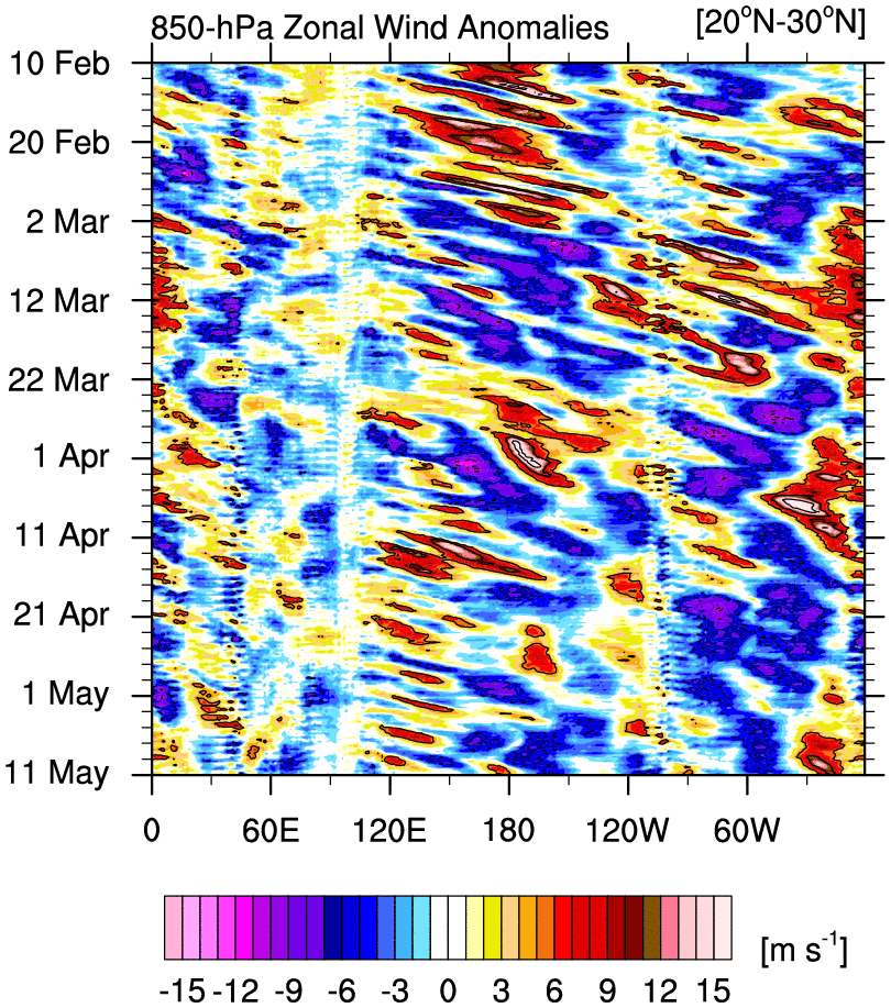
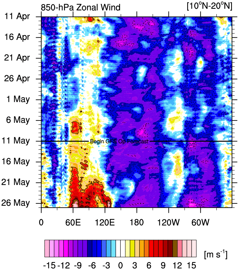
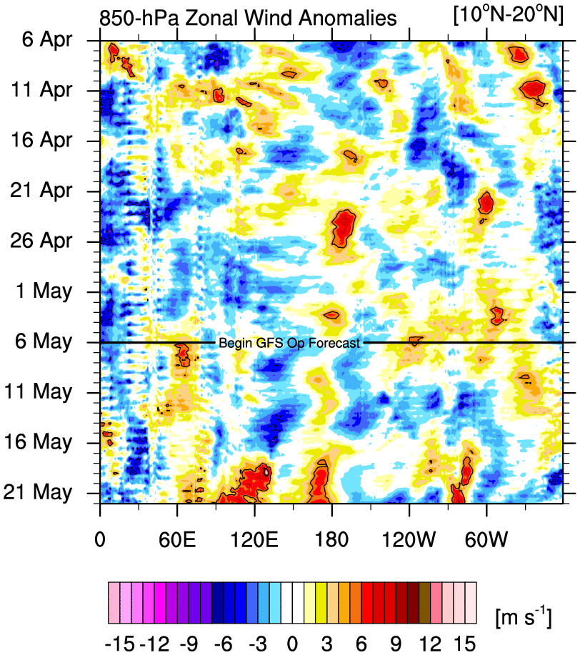
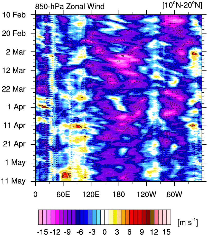
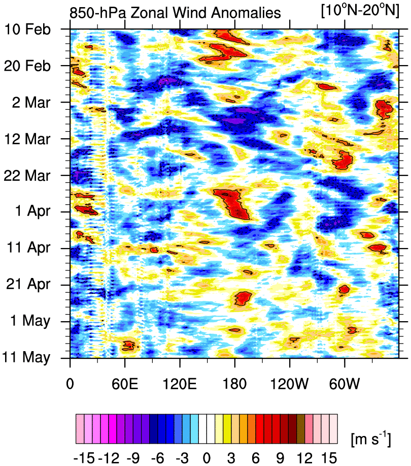
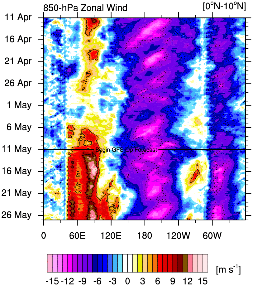
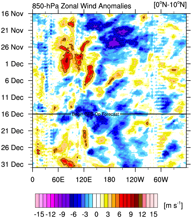
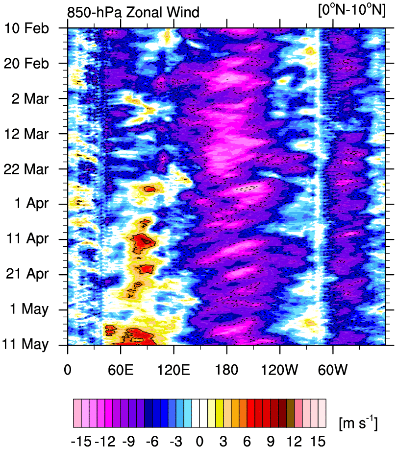
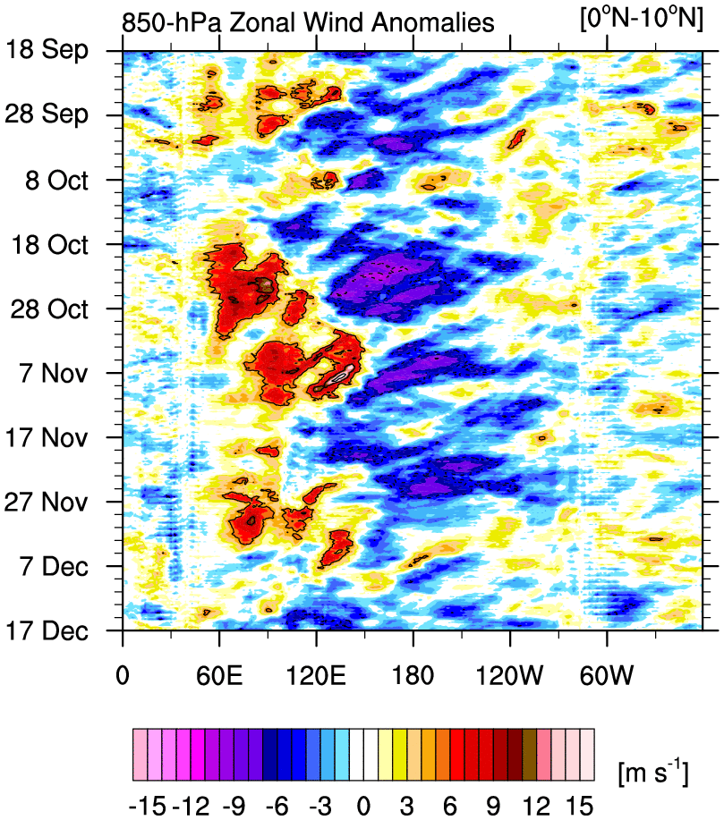
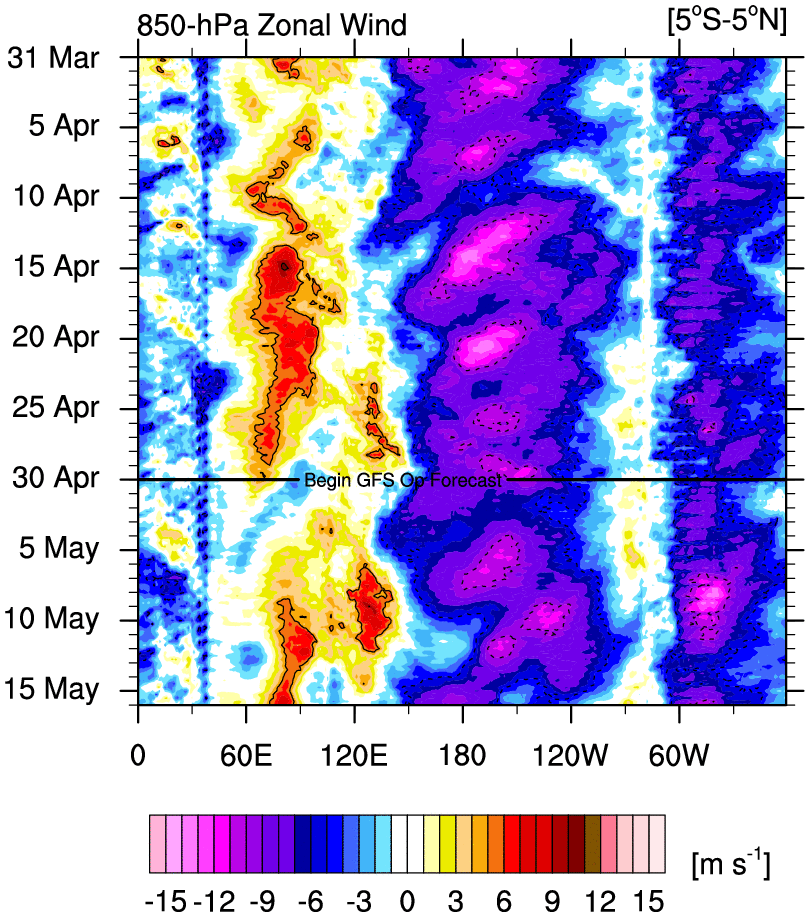
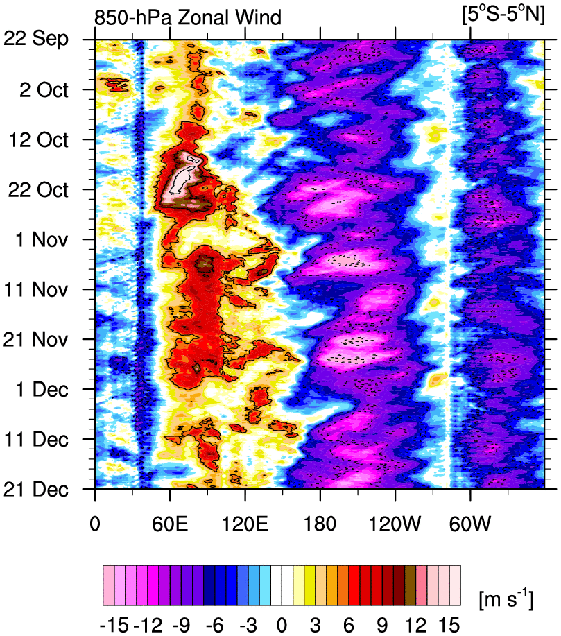
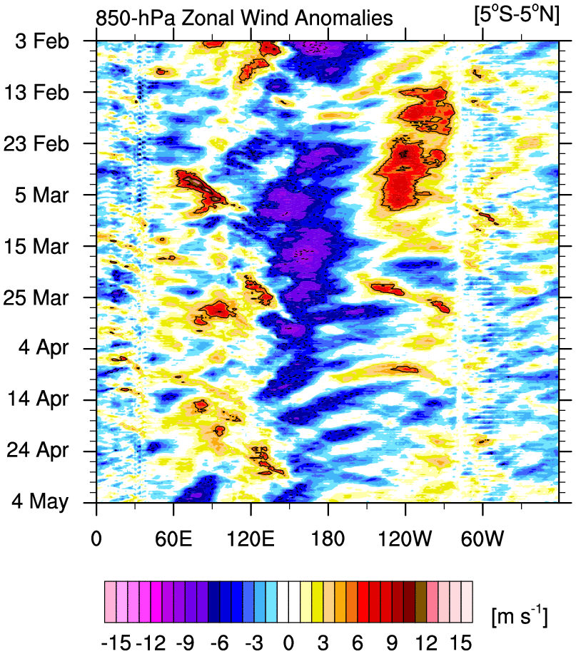
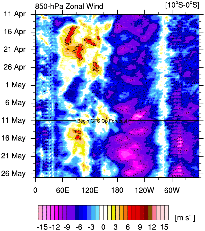
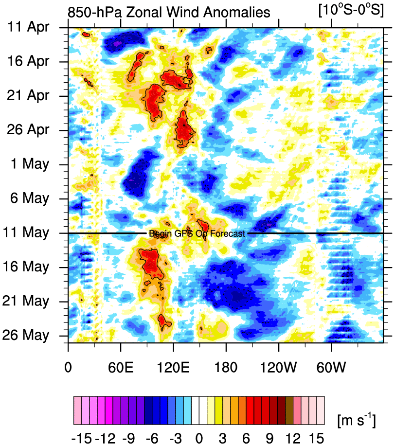
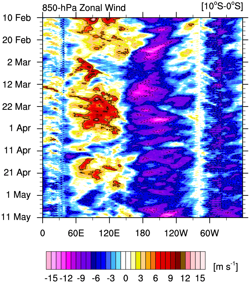
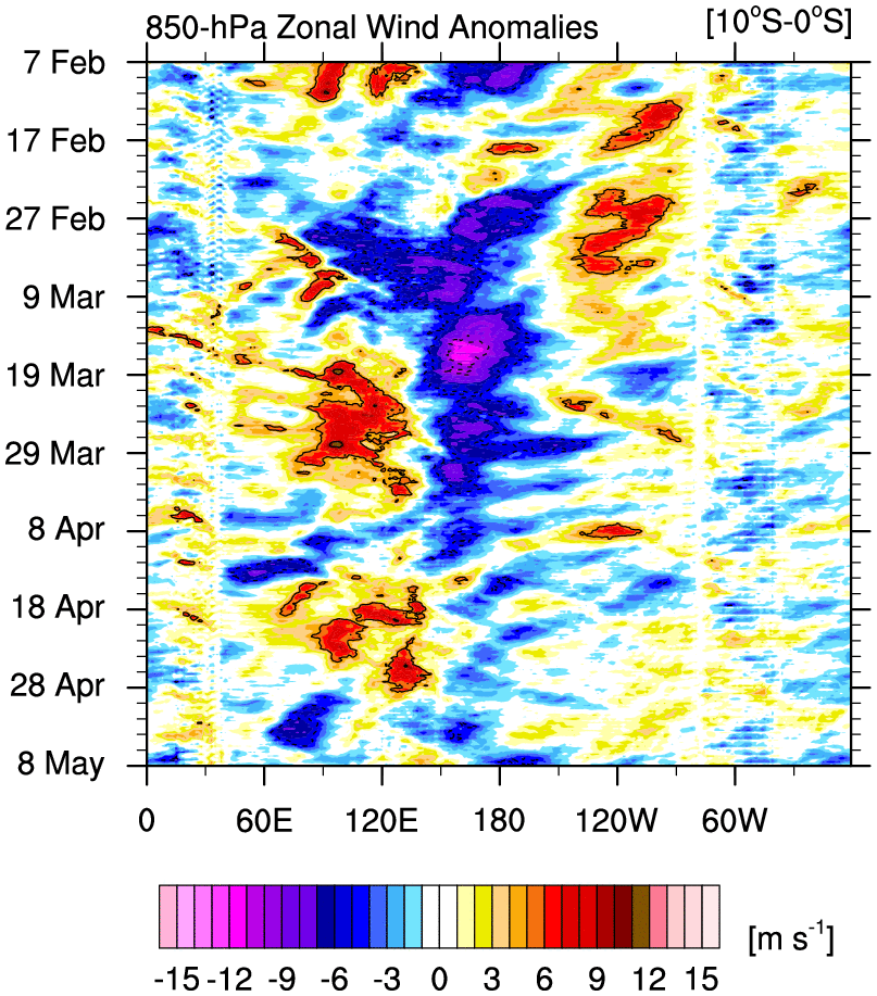
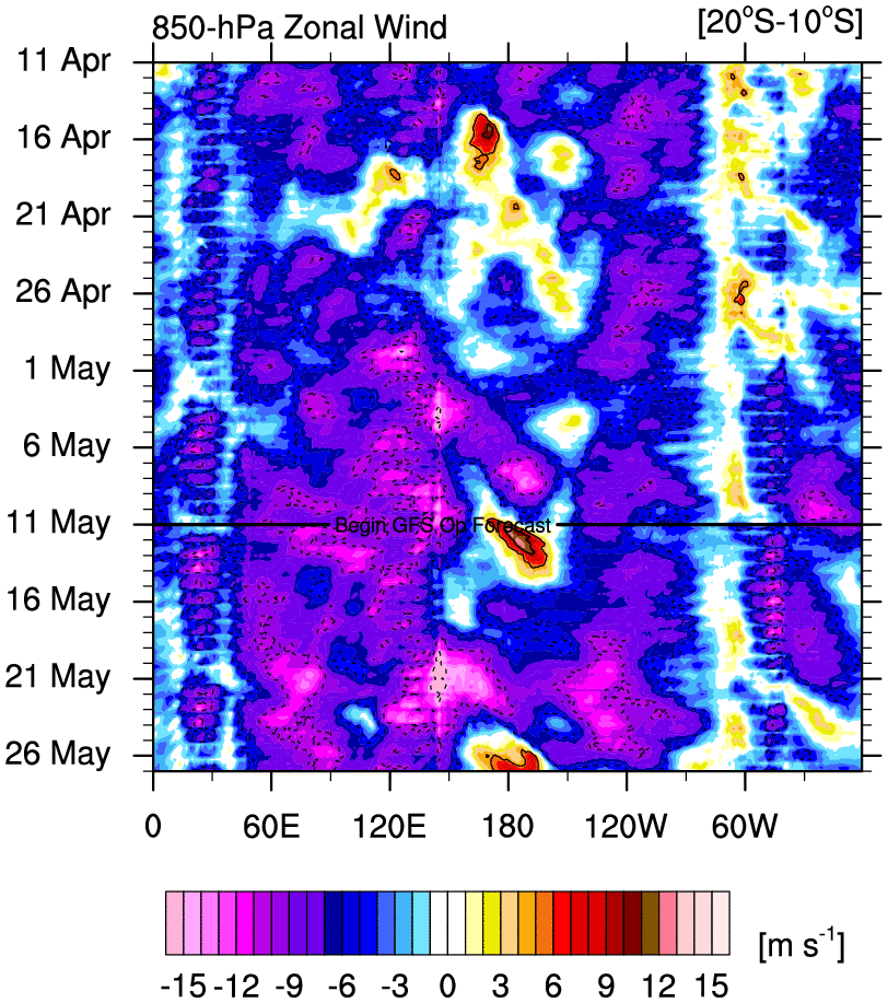
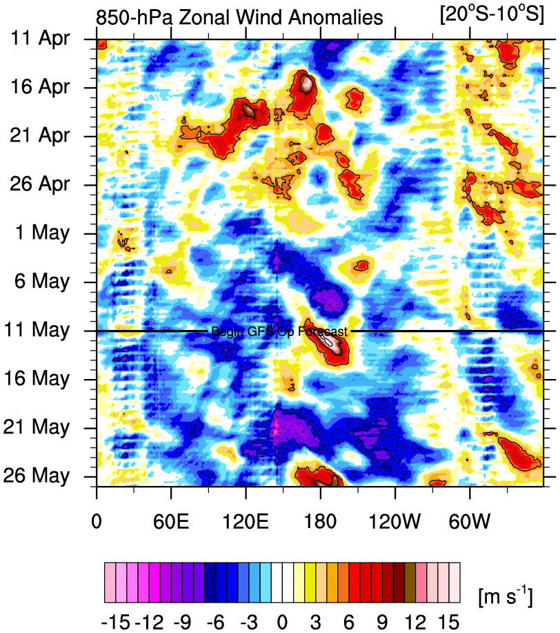
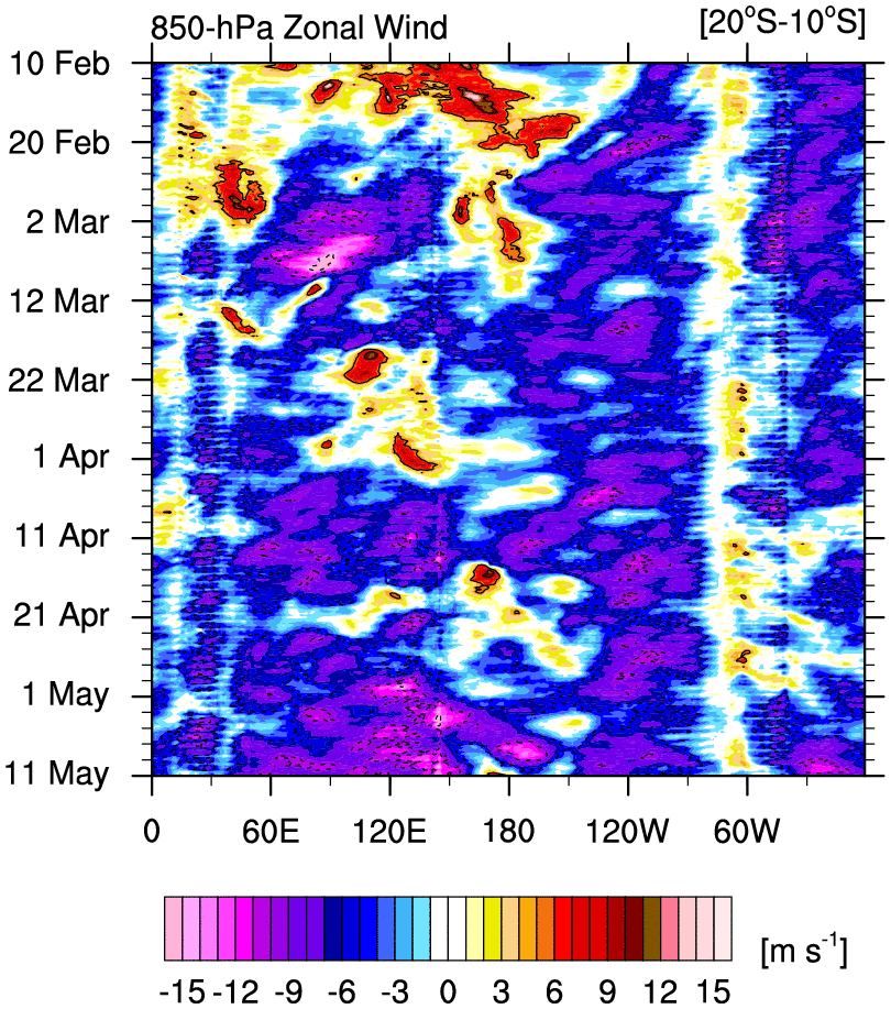
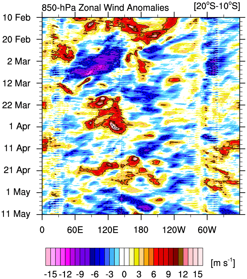
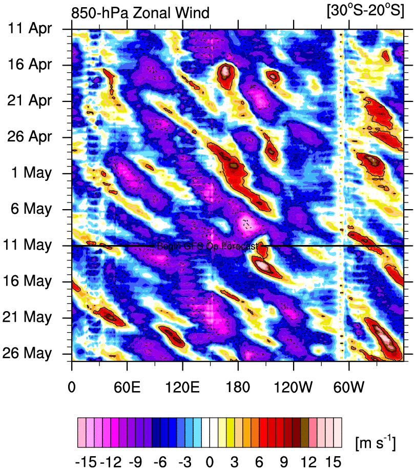
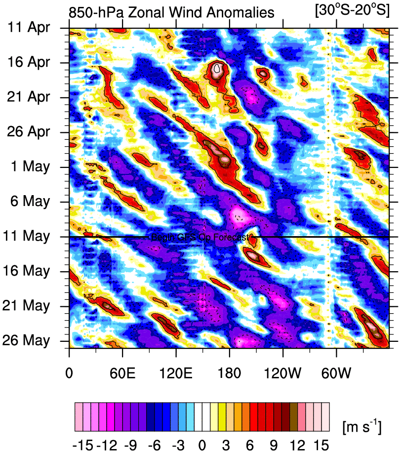
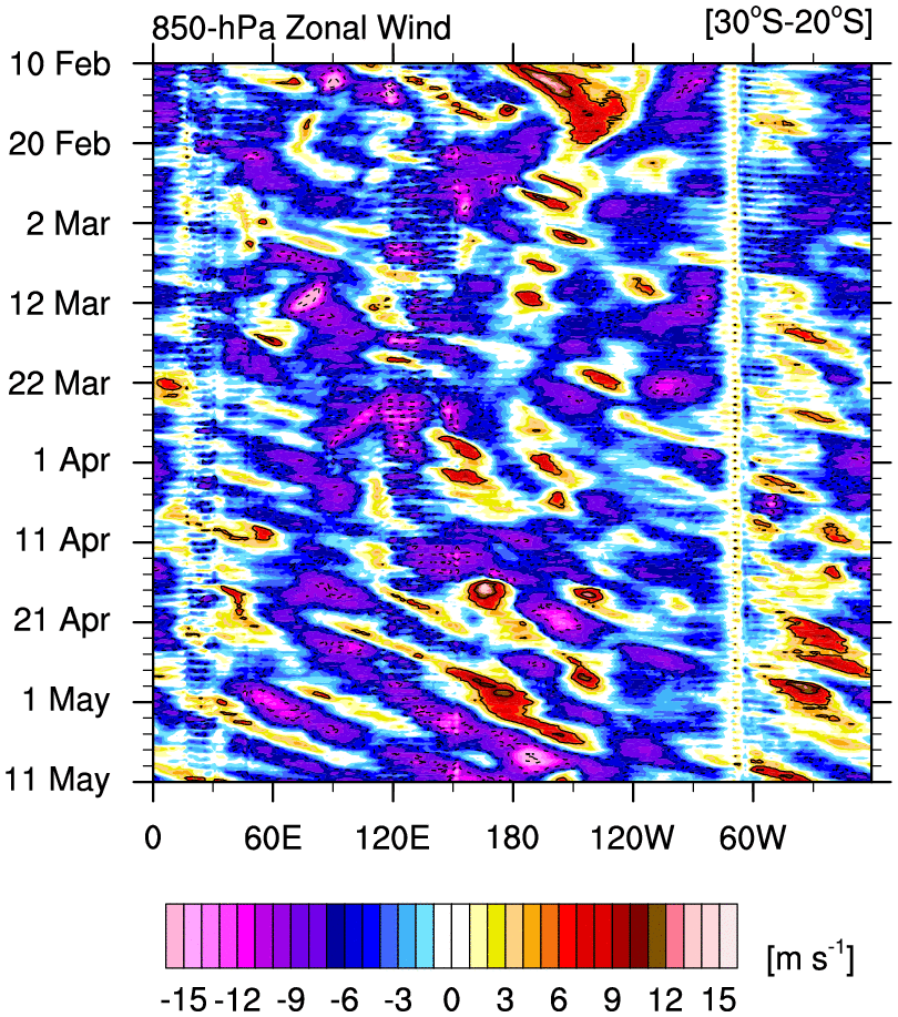
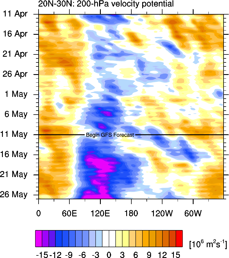
850 hPa Global Zonal Wind Time–Longitude Plots
o Time–longitude plots of 850 hPa U for each region, averaged over the indicated latitude bands
o GFS forecast attached to 30 Day plots
30 Day 90 Day
20°N – 30°N total anom total anom
10°N – 20°N total anom total anom
Eq – 10°N total anom total anom
5°S – 5°N total anom total anom
10°S – Eq total anom total anom
20°S – 10°S total anom total anom
30°S – 20°S total anom total anom
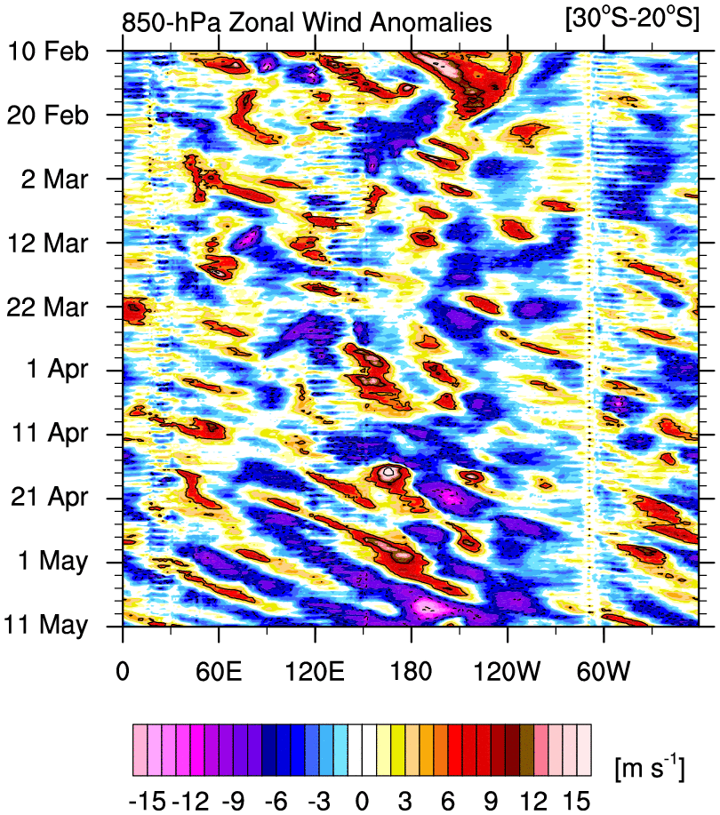
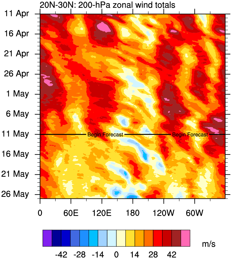
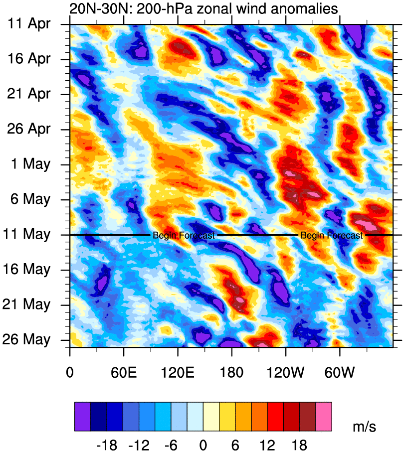
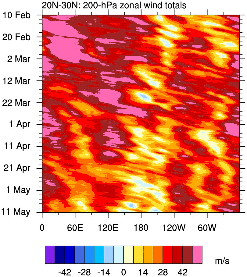
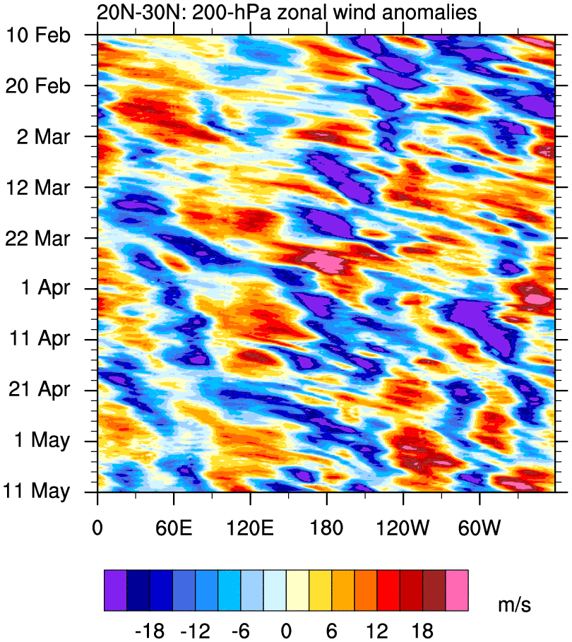
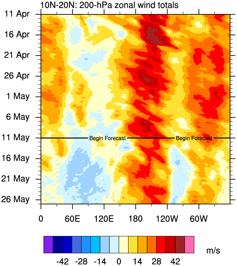
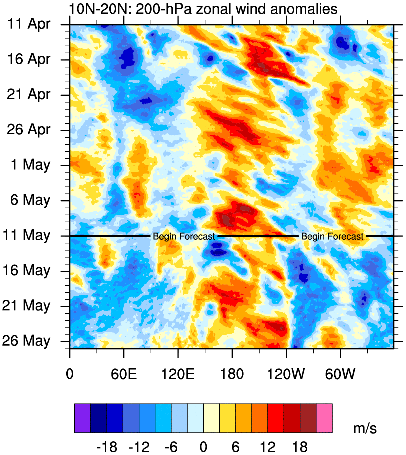
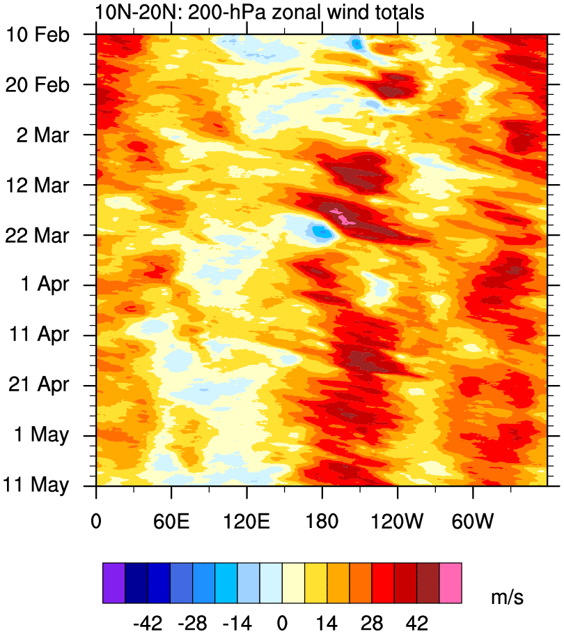
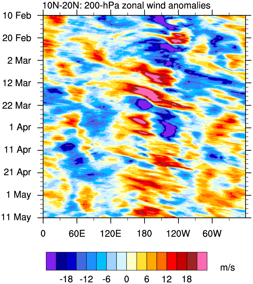
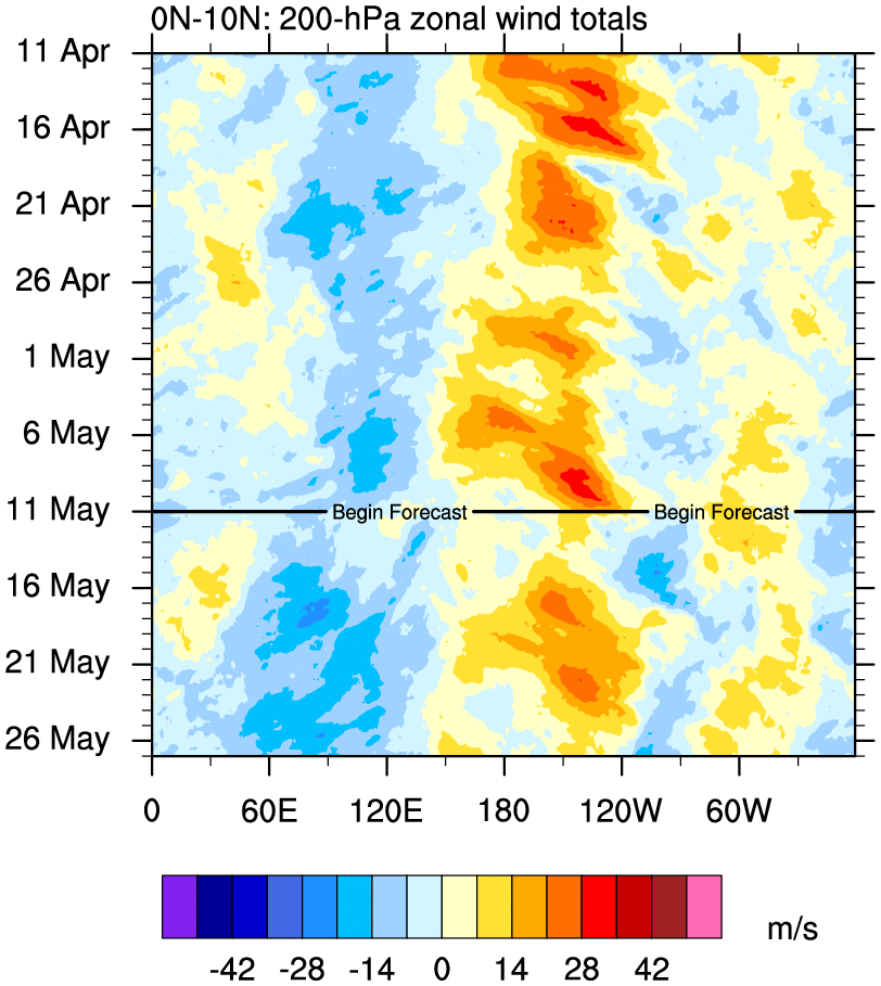
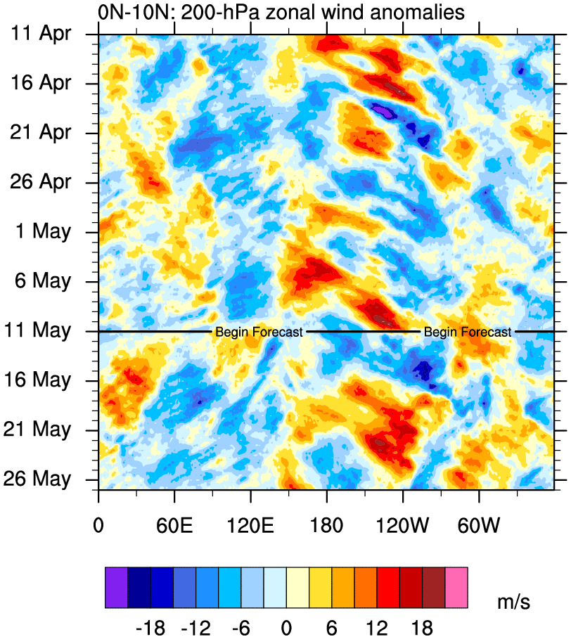
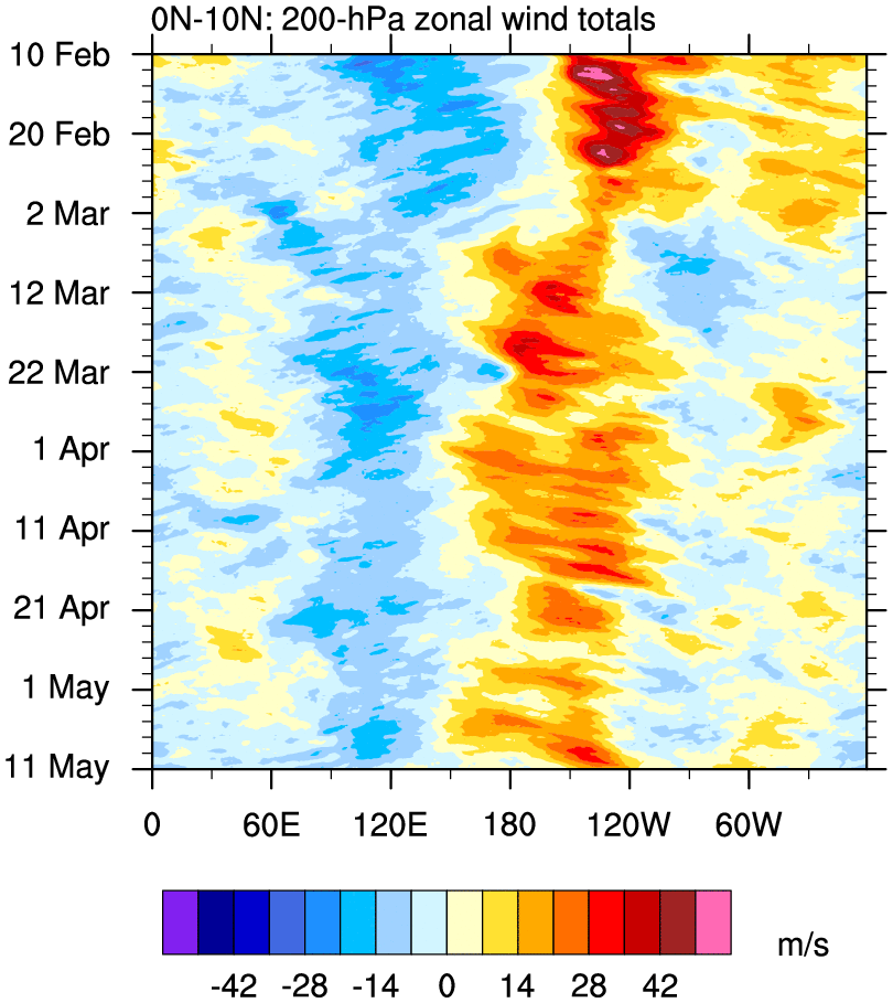
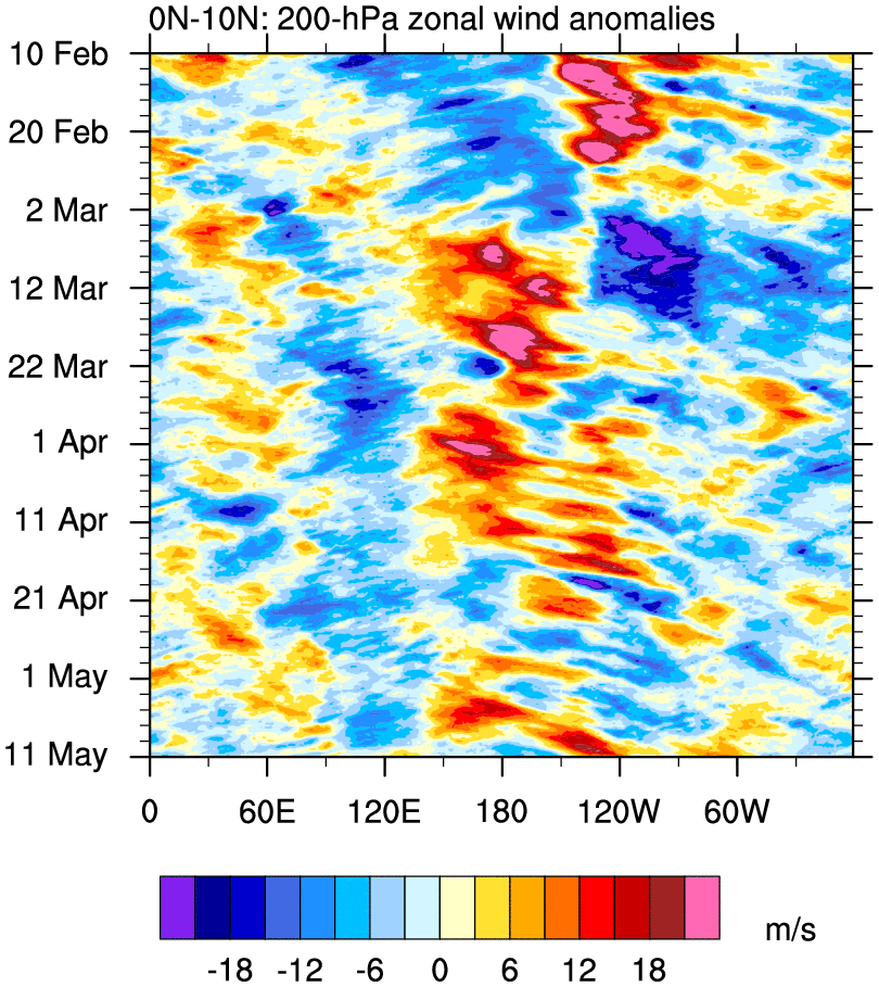
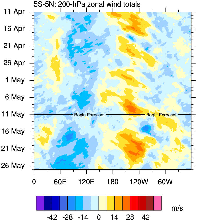
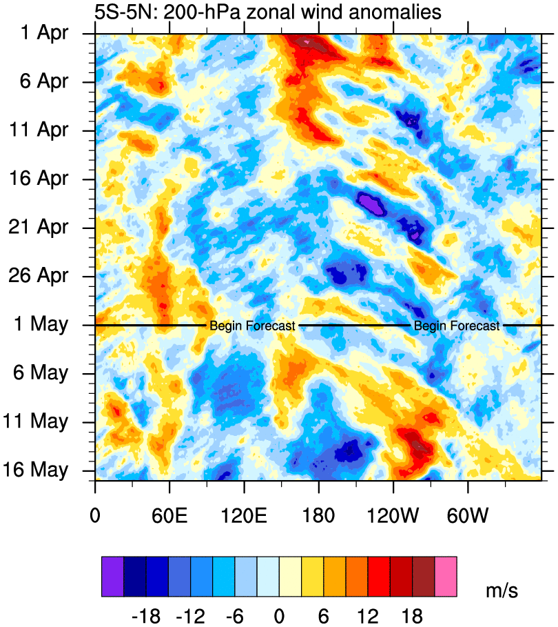
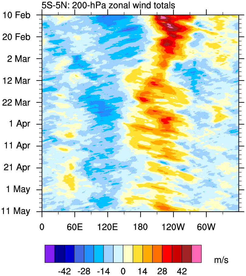
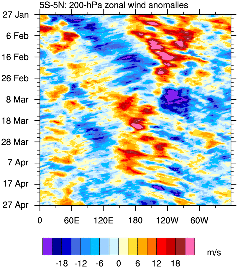
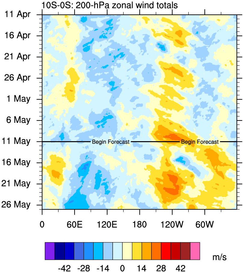
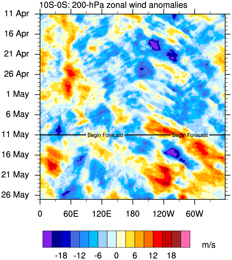
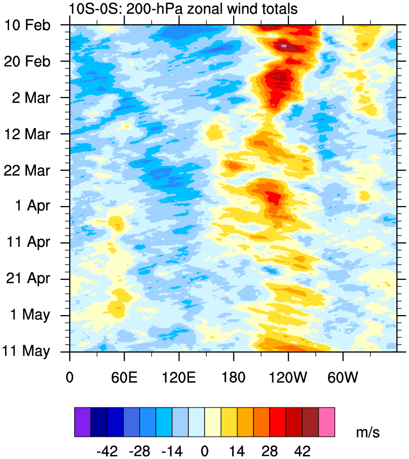
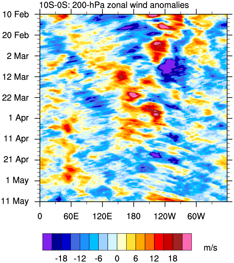
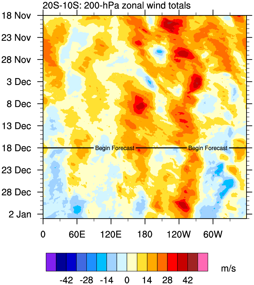
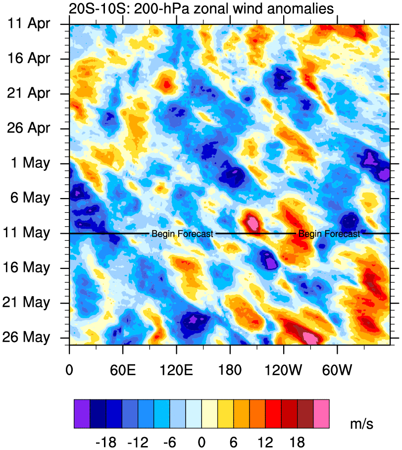
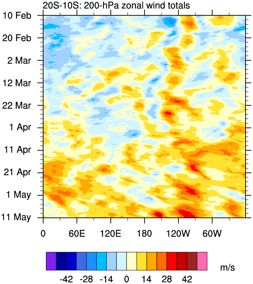
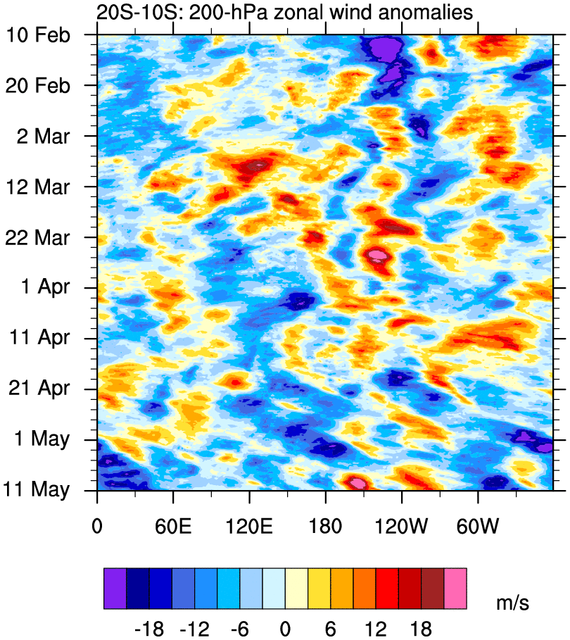
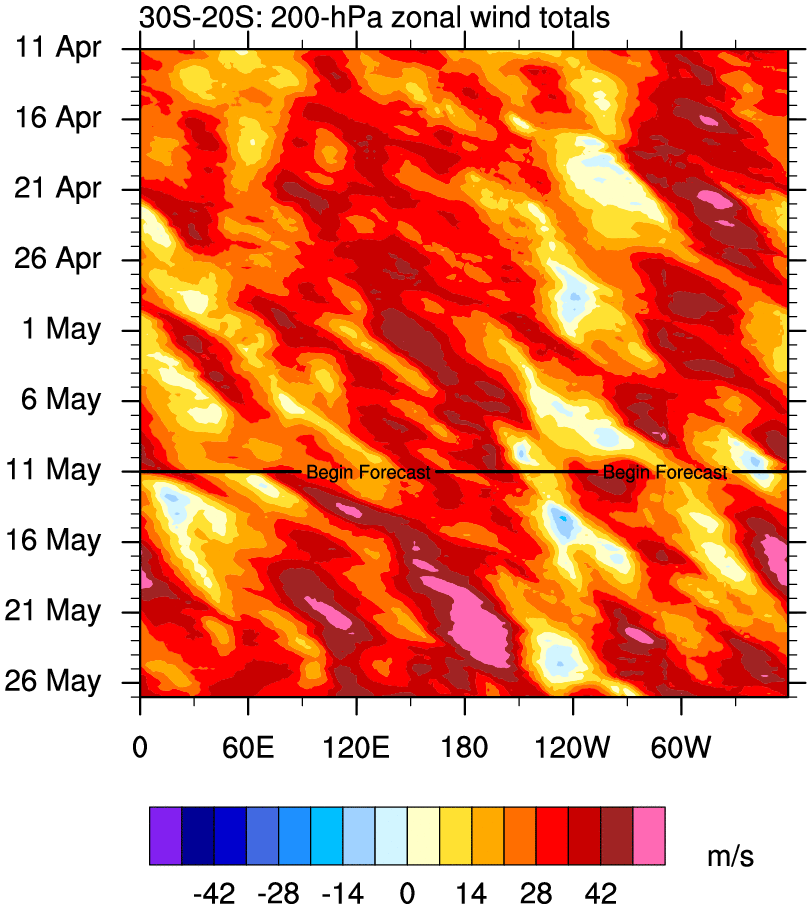
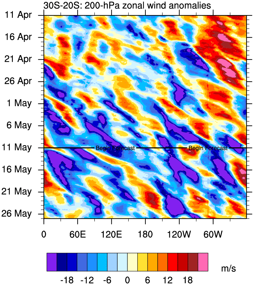
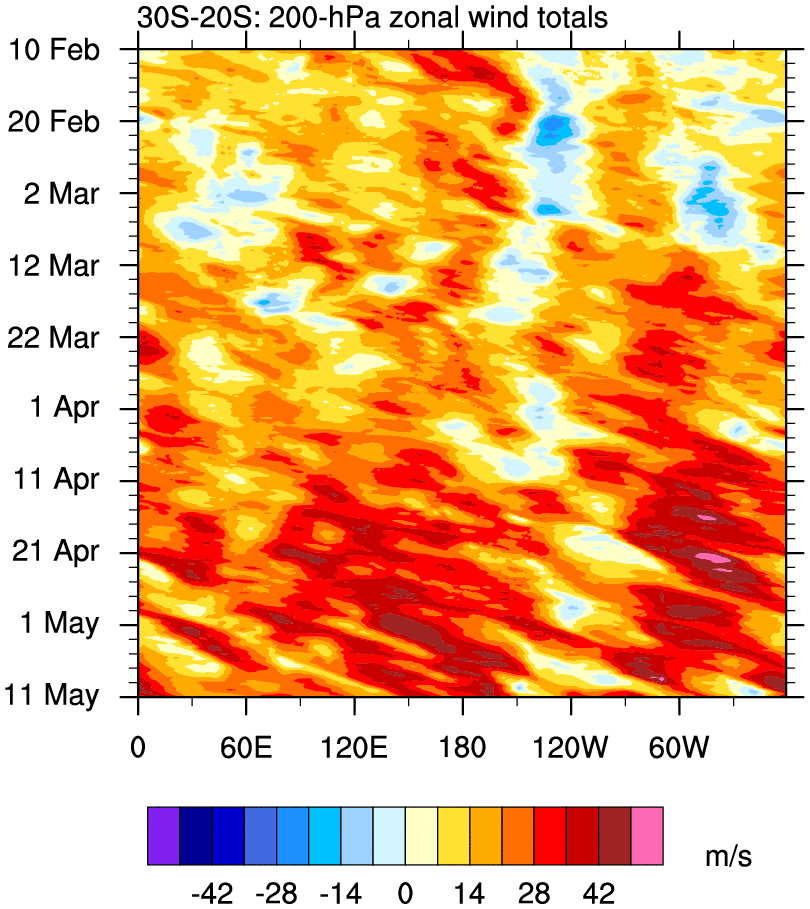
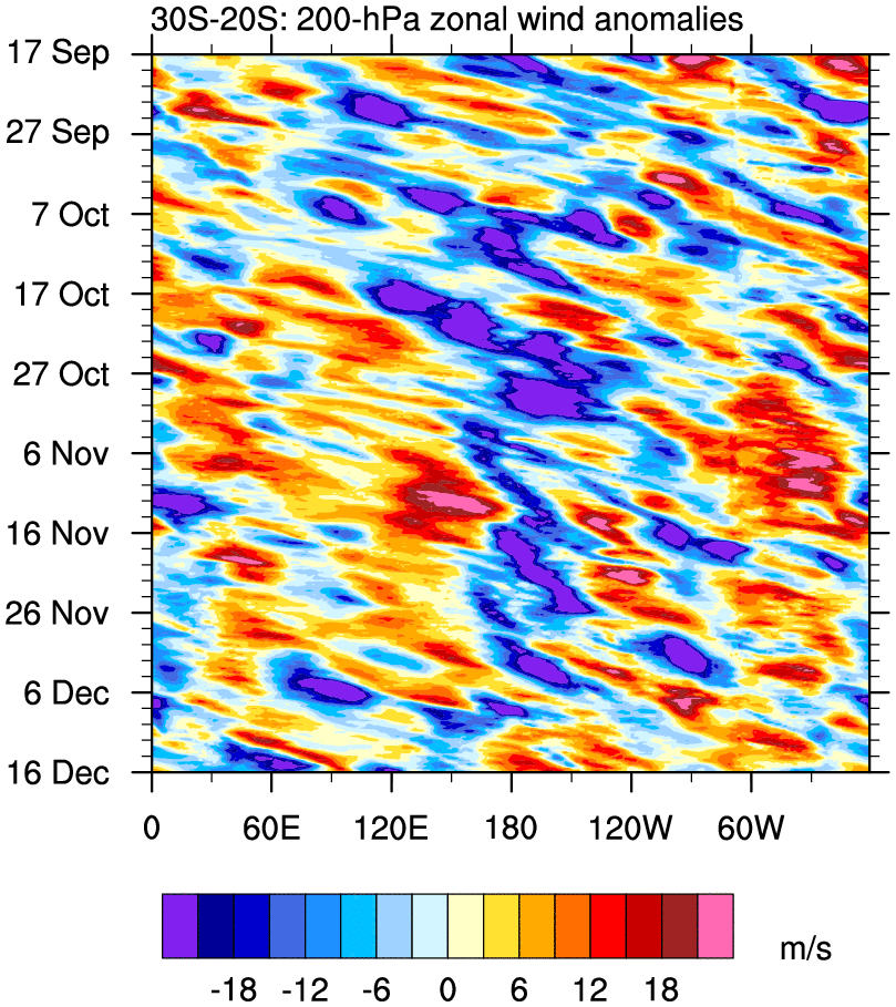
200 hPa Global Zonal Wind Time–Longitude Plots
o Time–longitude plots of 200 hPa U for each region, averaged over the indicated latitude bands
o GFS forecast attached to 30 Day plots
30 Day 90 Day
20°N – 30°N total anom total anom
10°N – 20°N total anom total anom
Eq – 10°N total anom total anom
5°S – 5°N total anom total anom
10°S – Eq total anom total anom
20°S – 10°S total anom total anom
30°S – 20°S total anom total anom
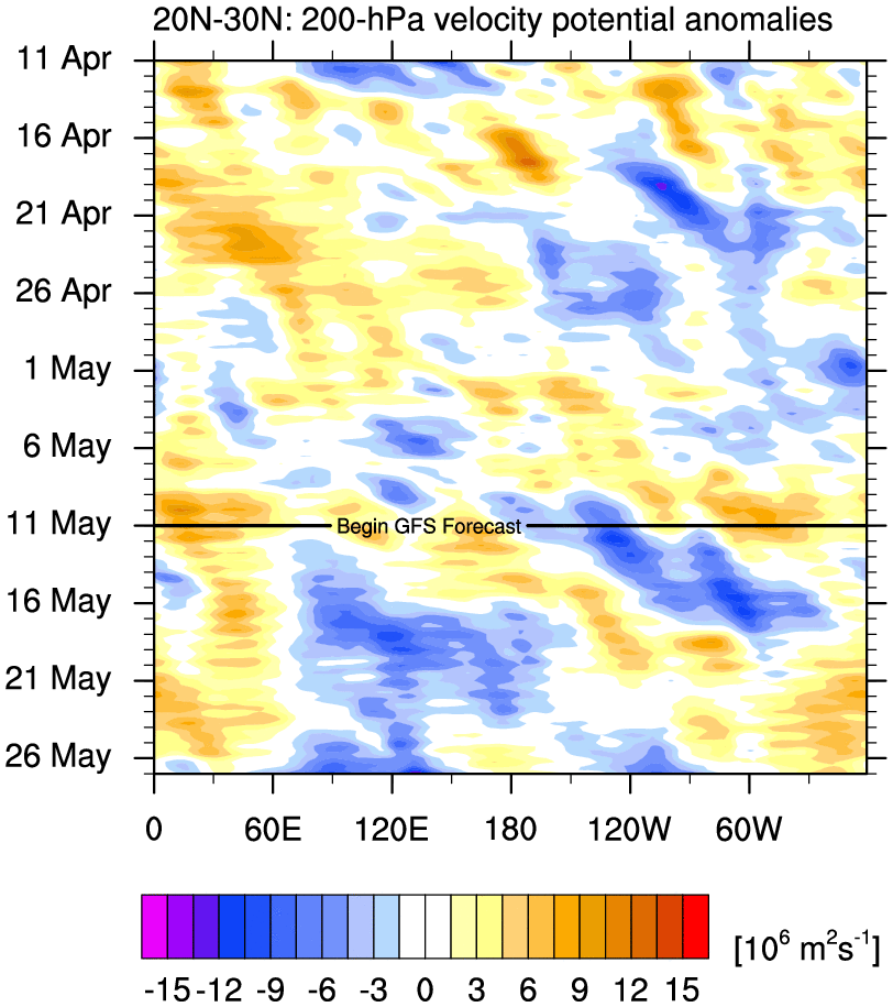
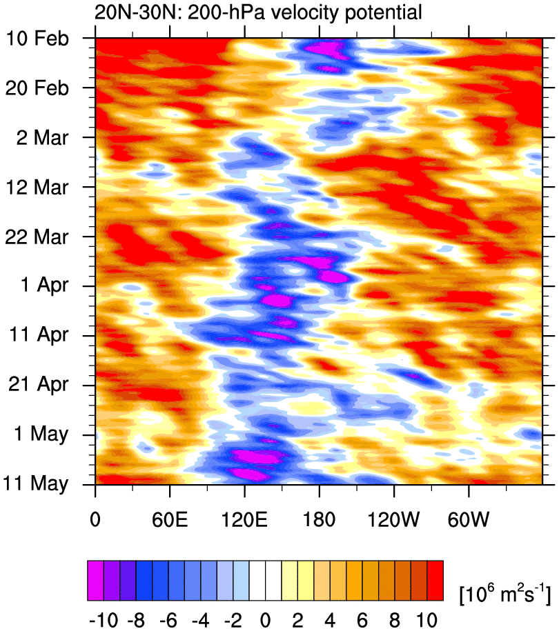
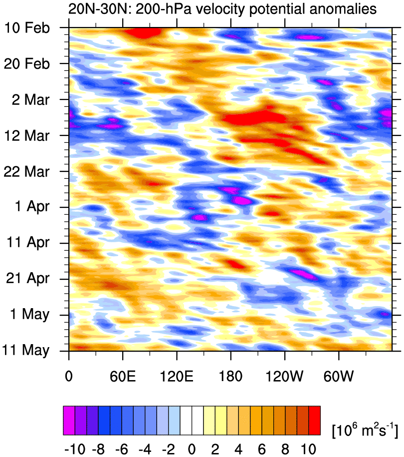
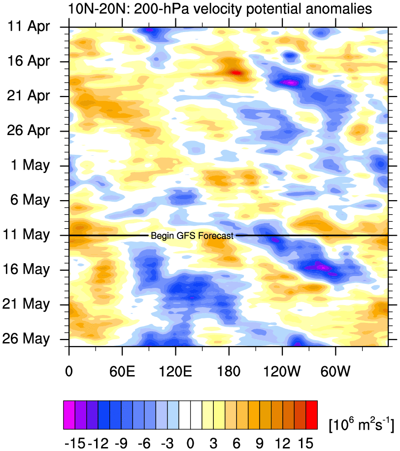
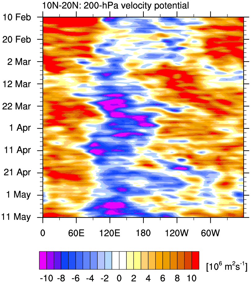
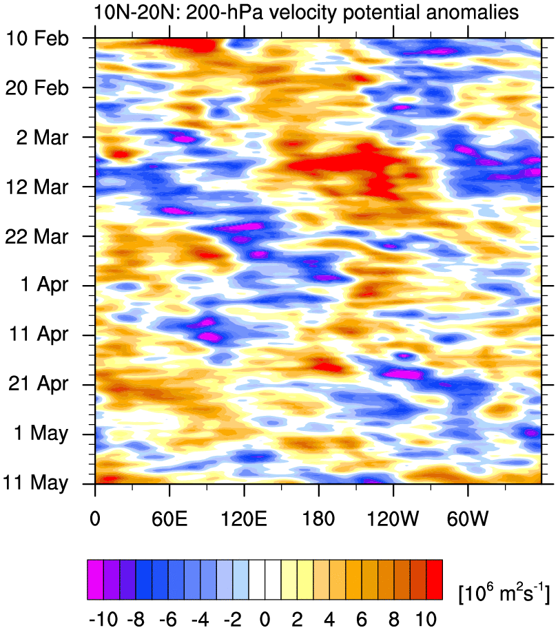
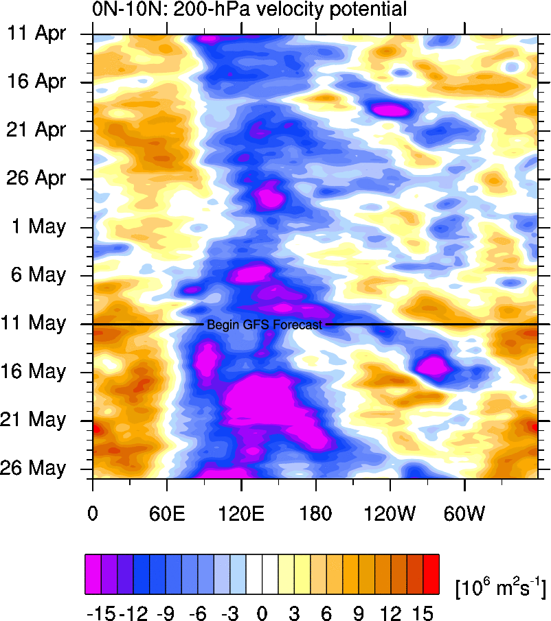
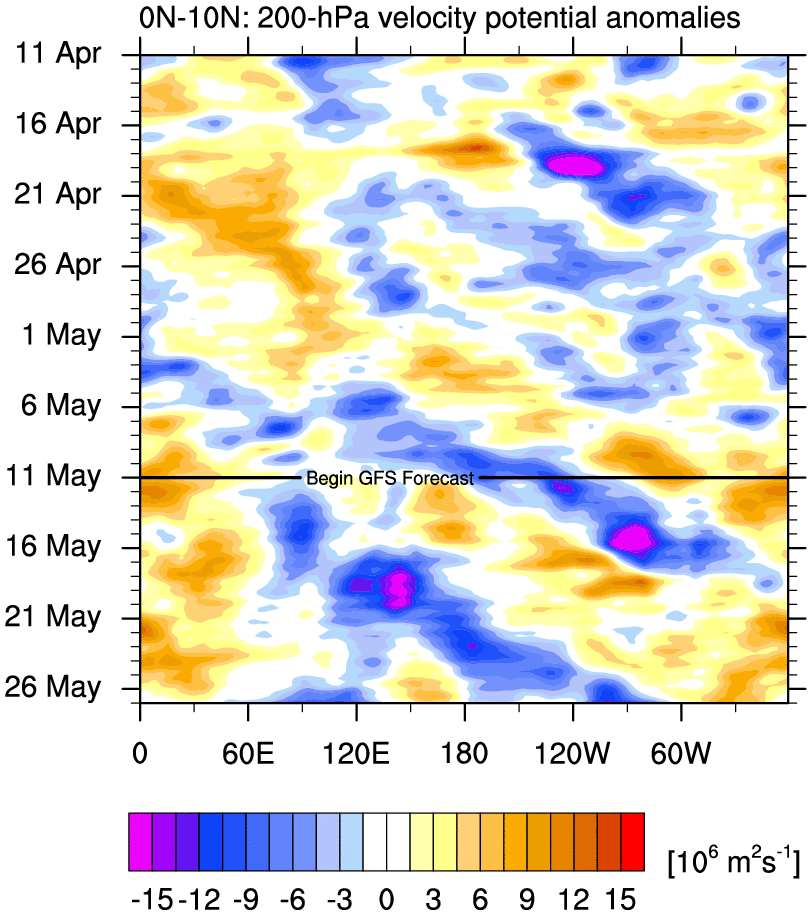
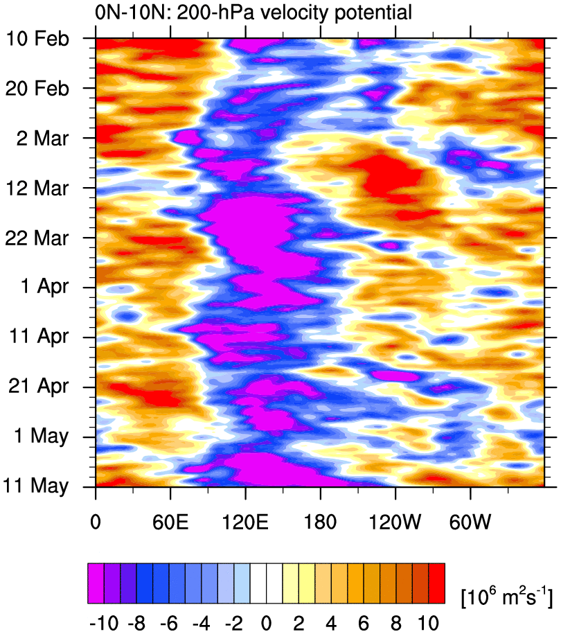
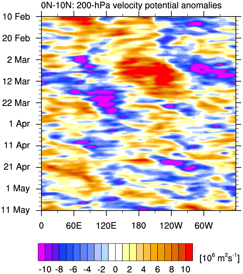
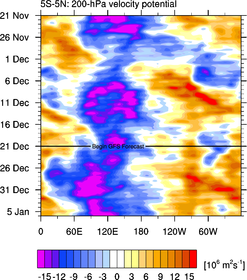
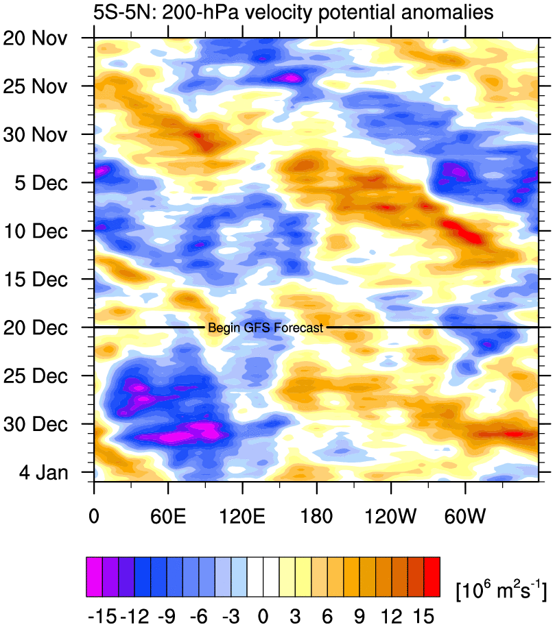
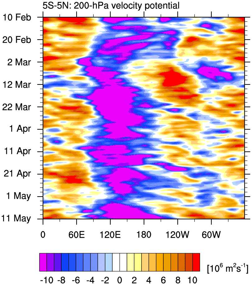
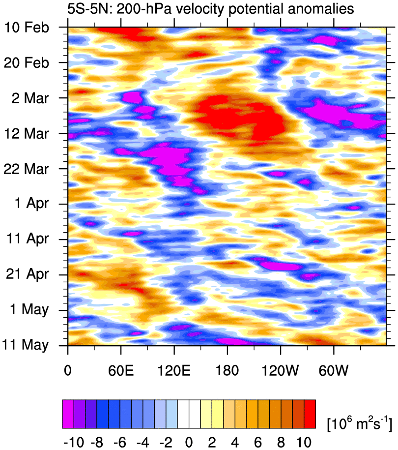
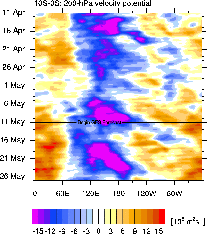
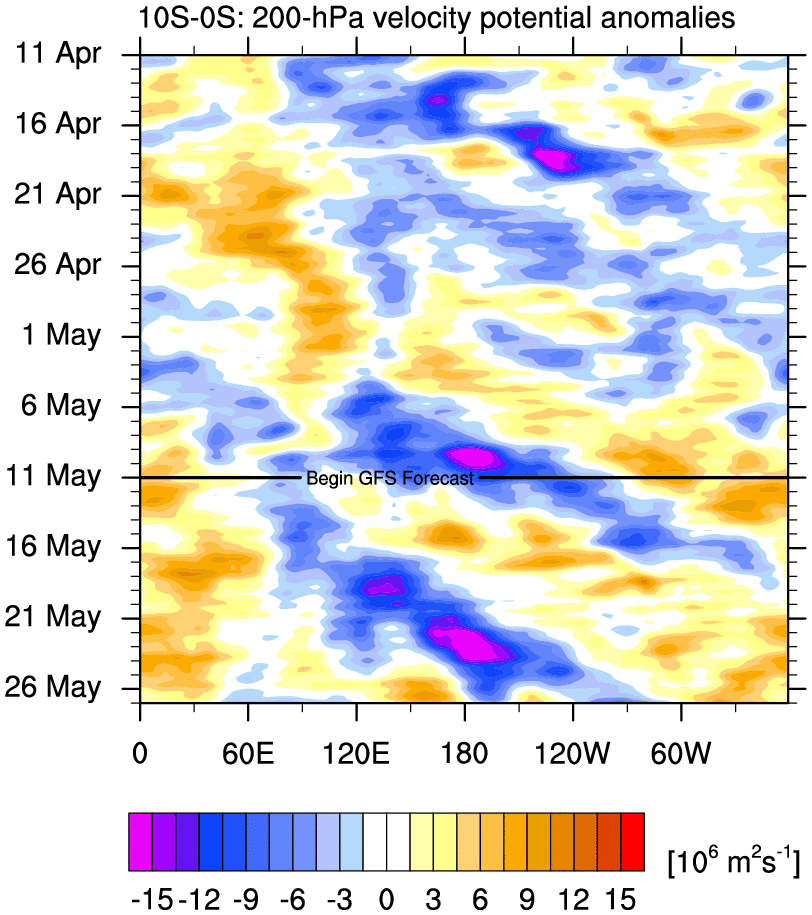
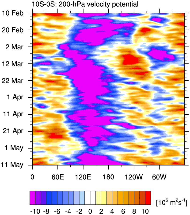
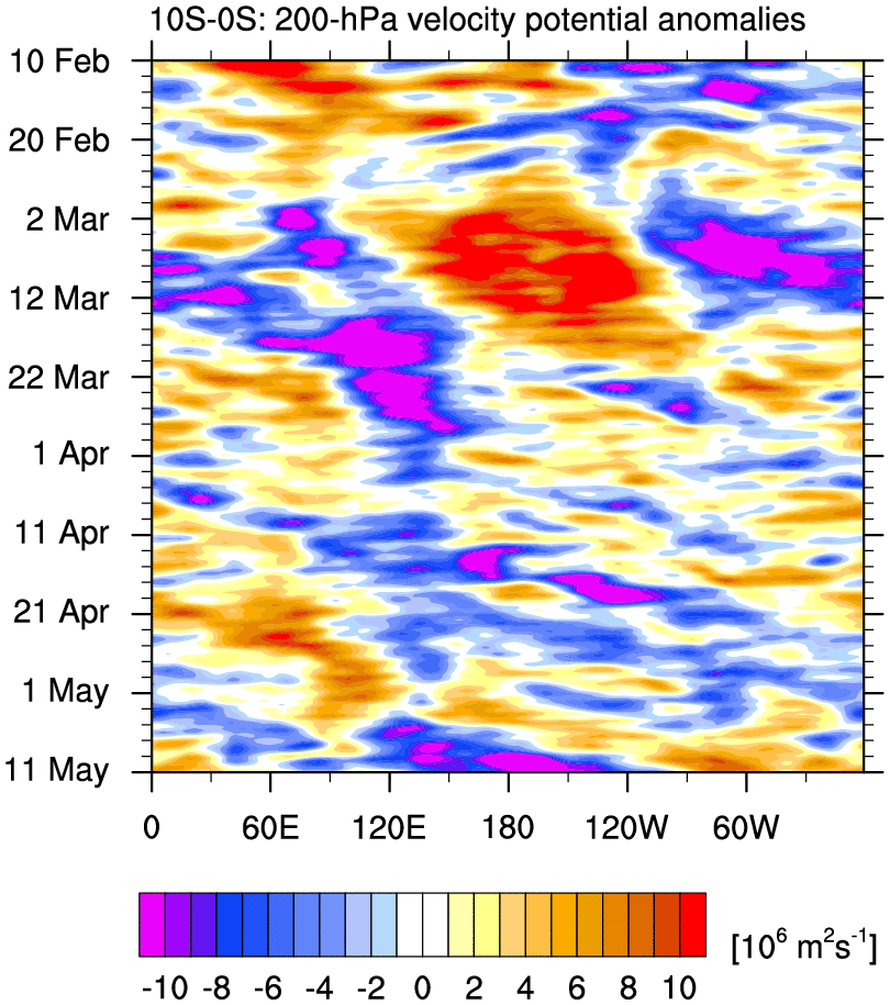
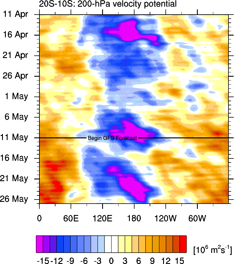
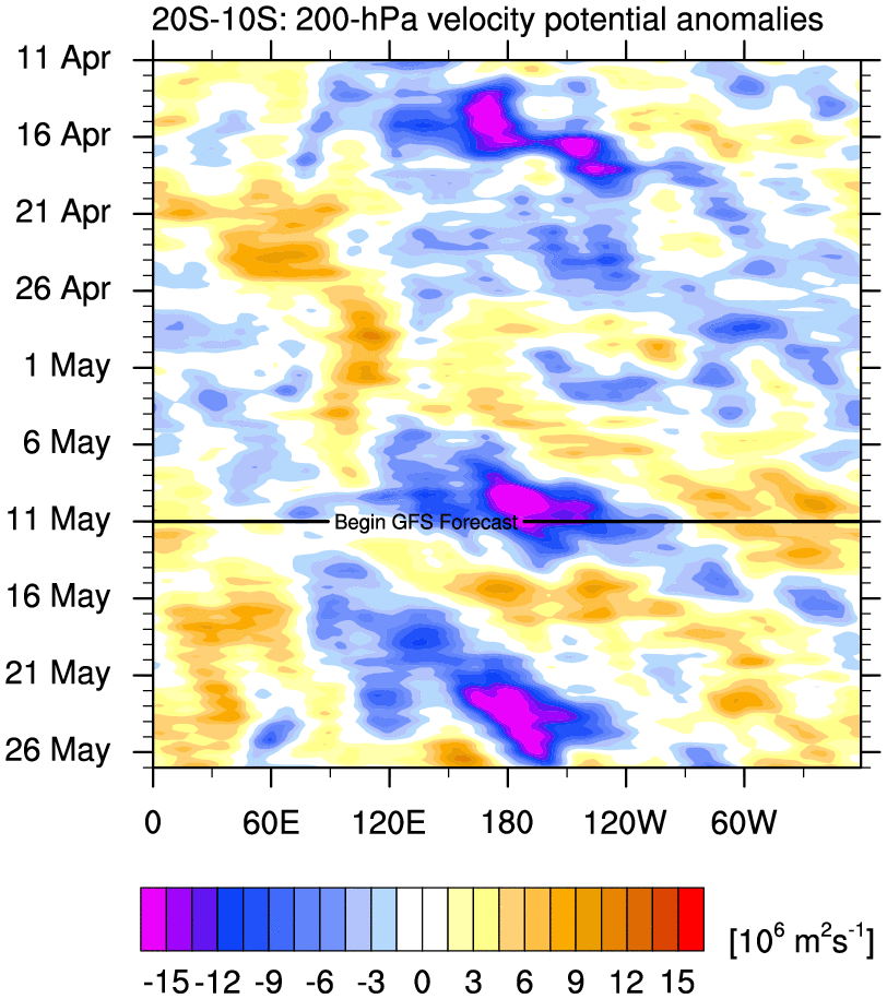
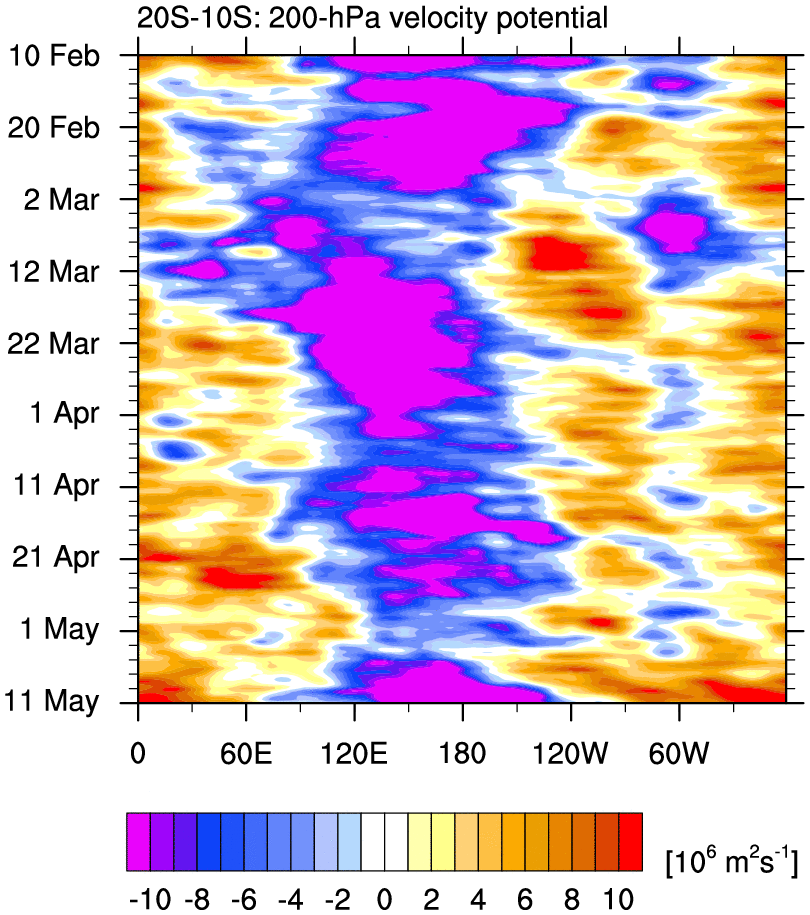
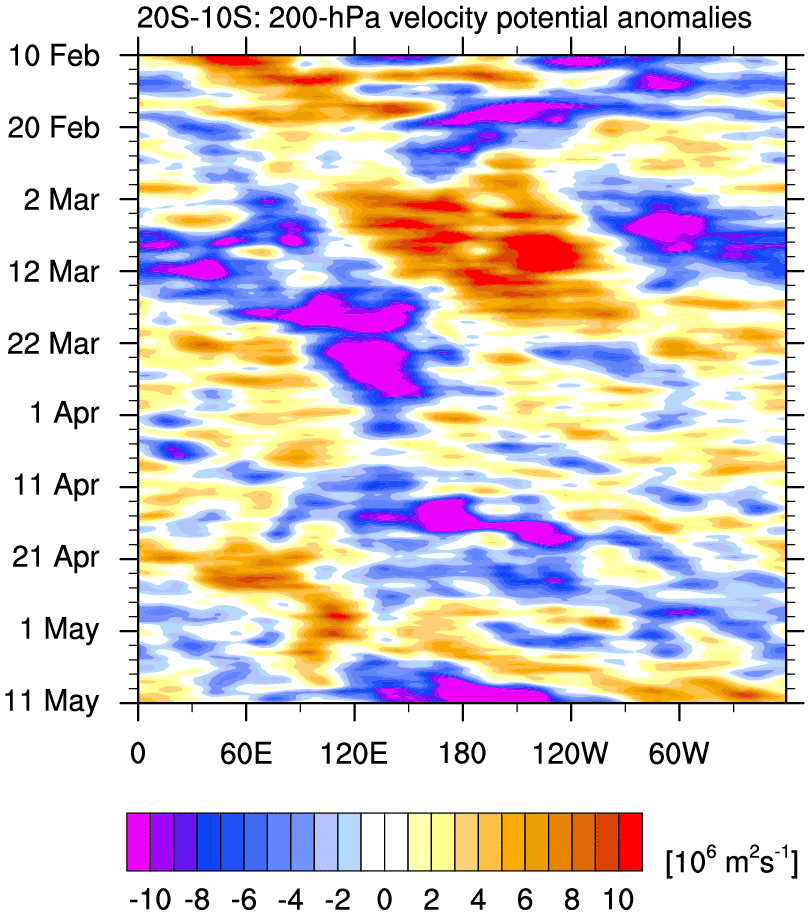
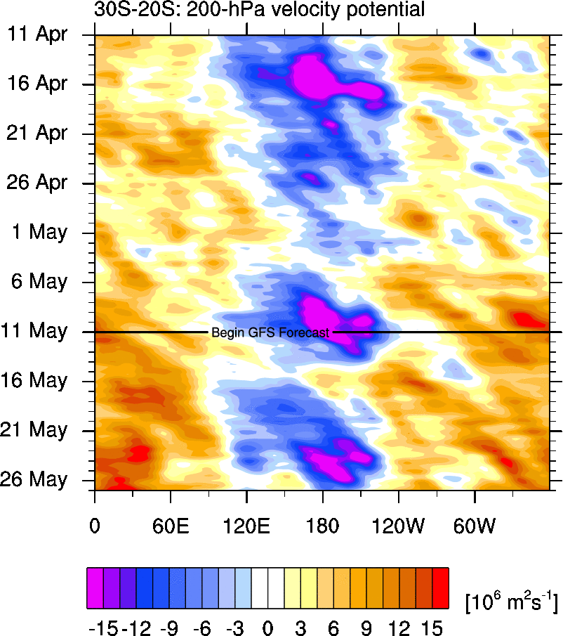
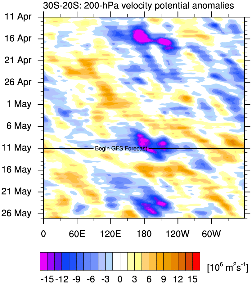
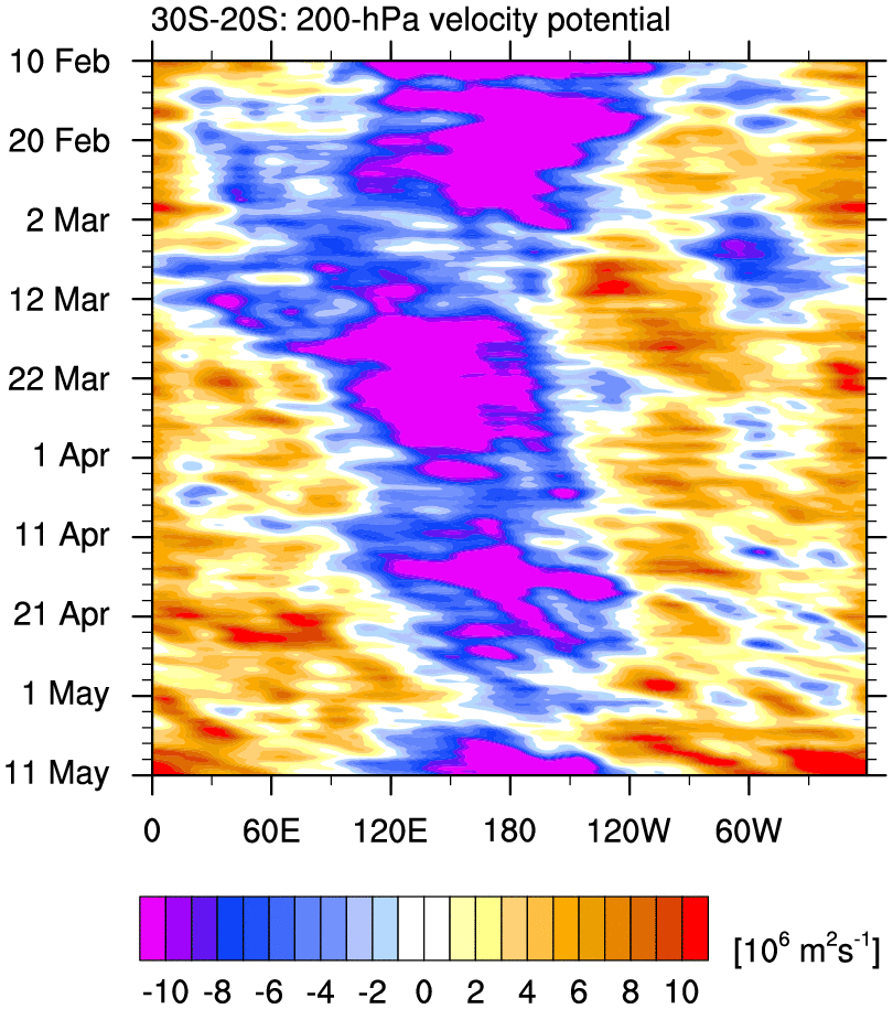
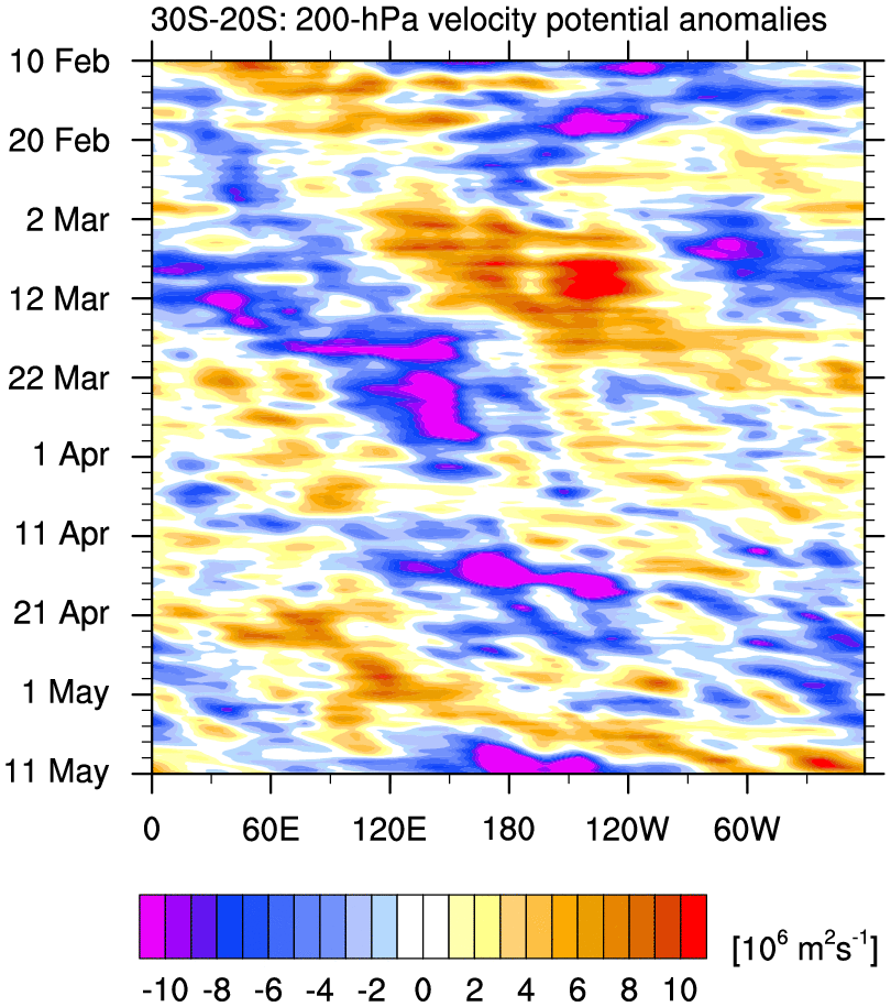
200 hPa Global Velocity Potential Time–Longitude Plots
o Time–longitude plots of velocity potential for each region, averaged over the indicated latitude bands
o GFS forecast attached to 30 Day plots
30 Day 90 Day
20°N – 30°N total anom total anom
10°N – 20°N total anom total anom
Eq – 10°N total anom total anom
5°S – 5°N total anom total anom
10°S – Eq total anom total anom
20°S – 10°S total anom total anom
30°S – 20°S total anom total anom
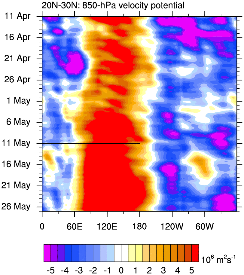
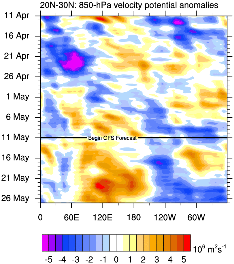
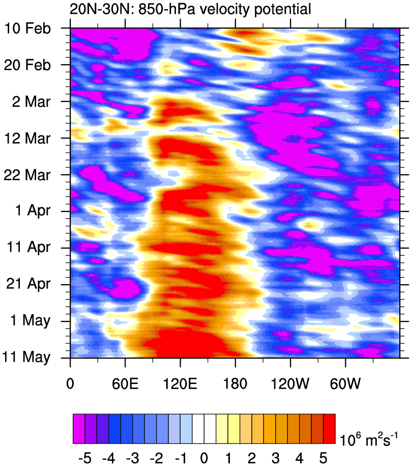
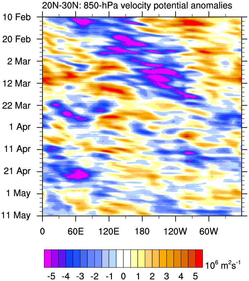
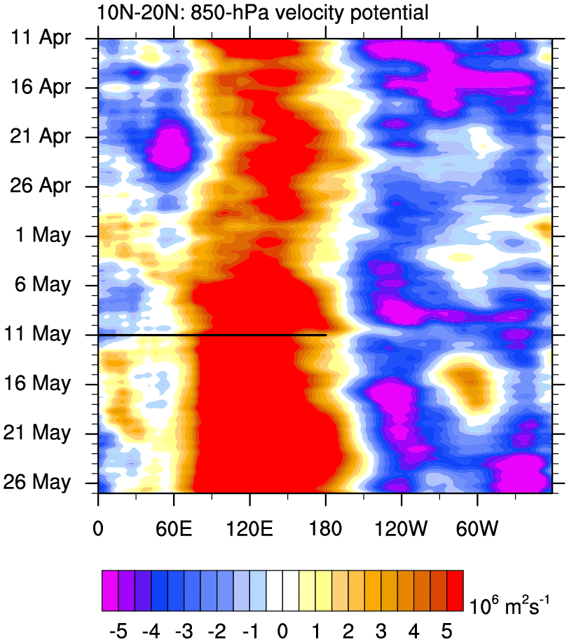
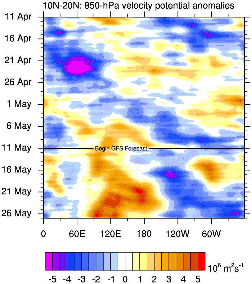
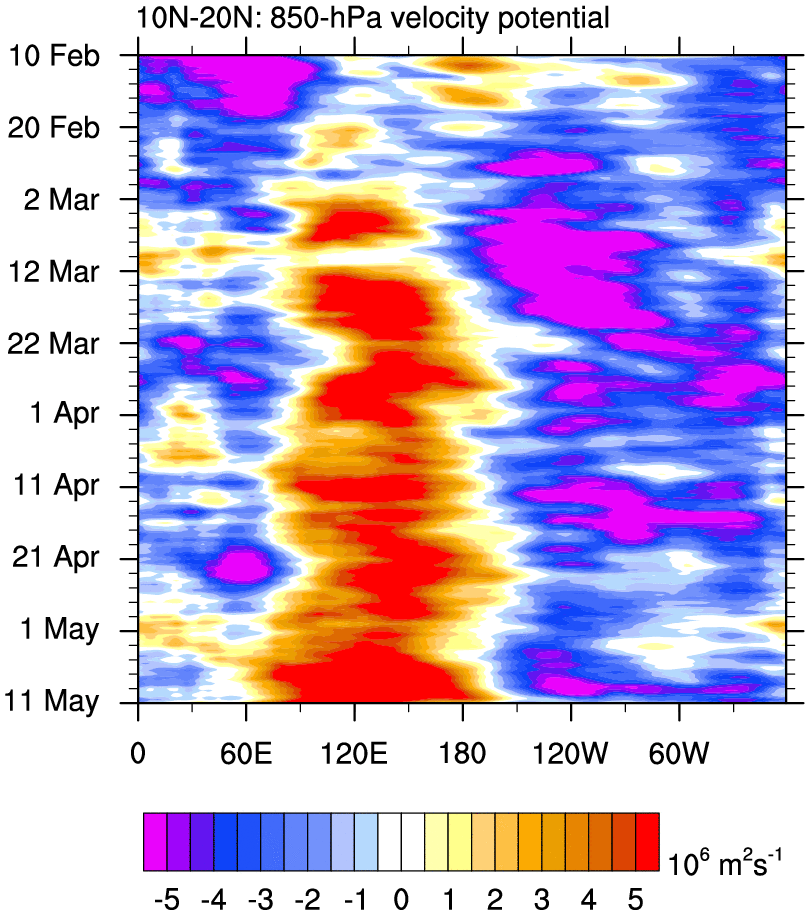
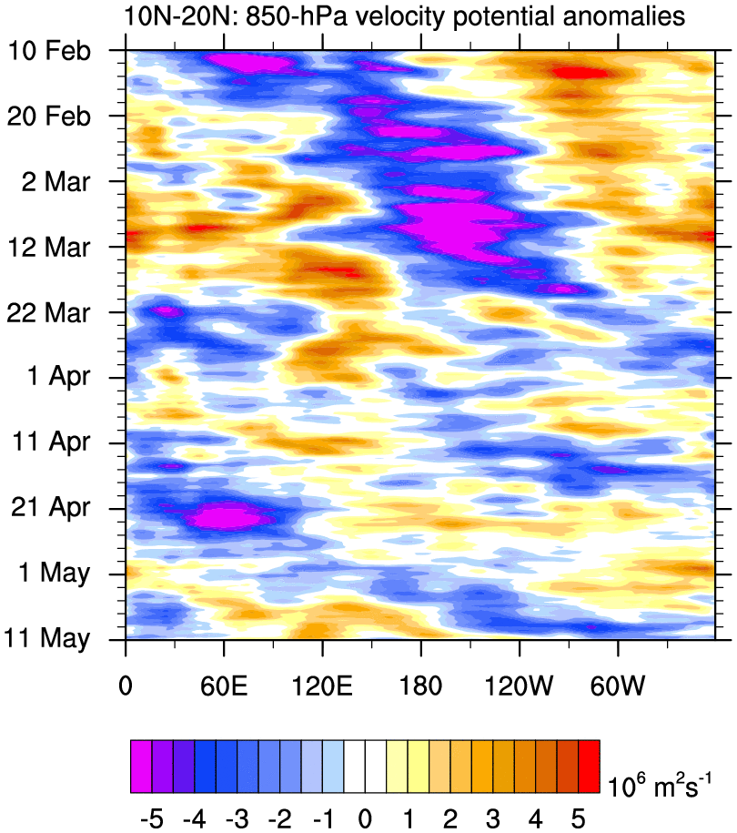
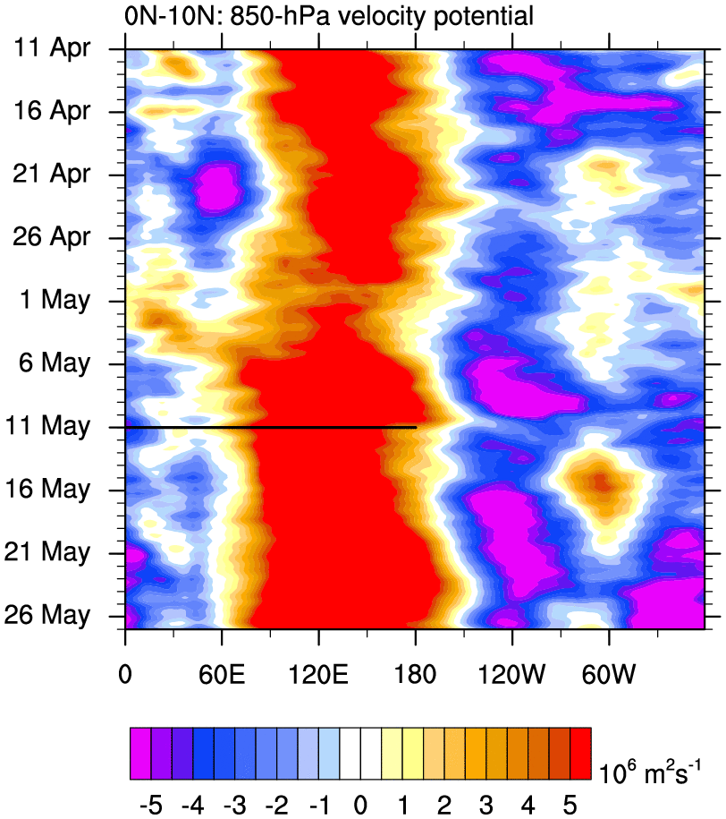
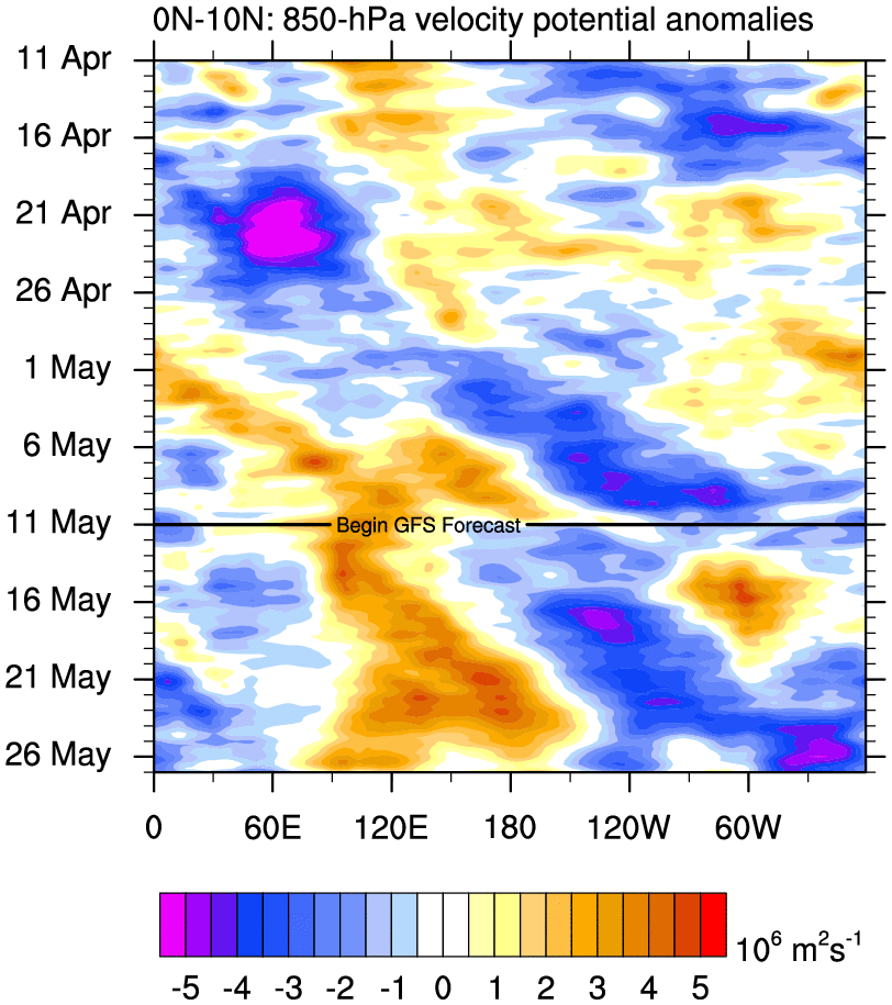
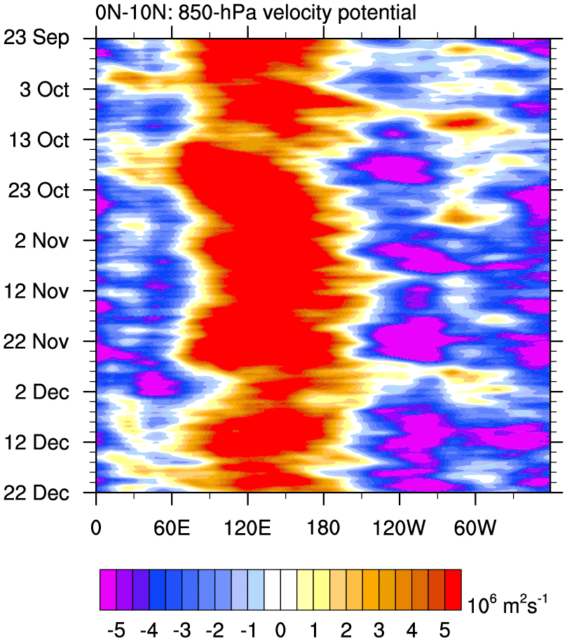
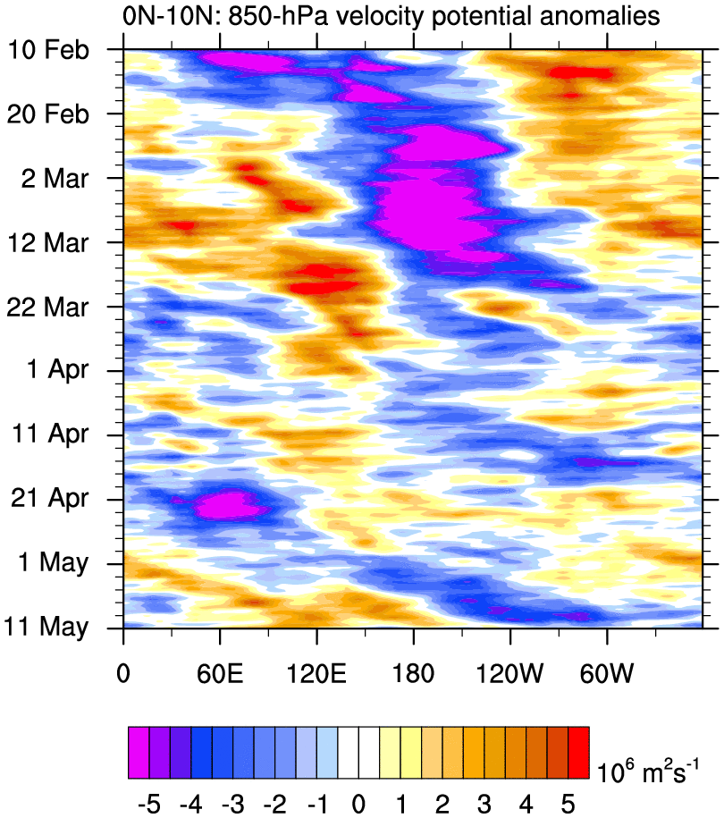
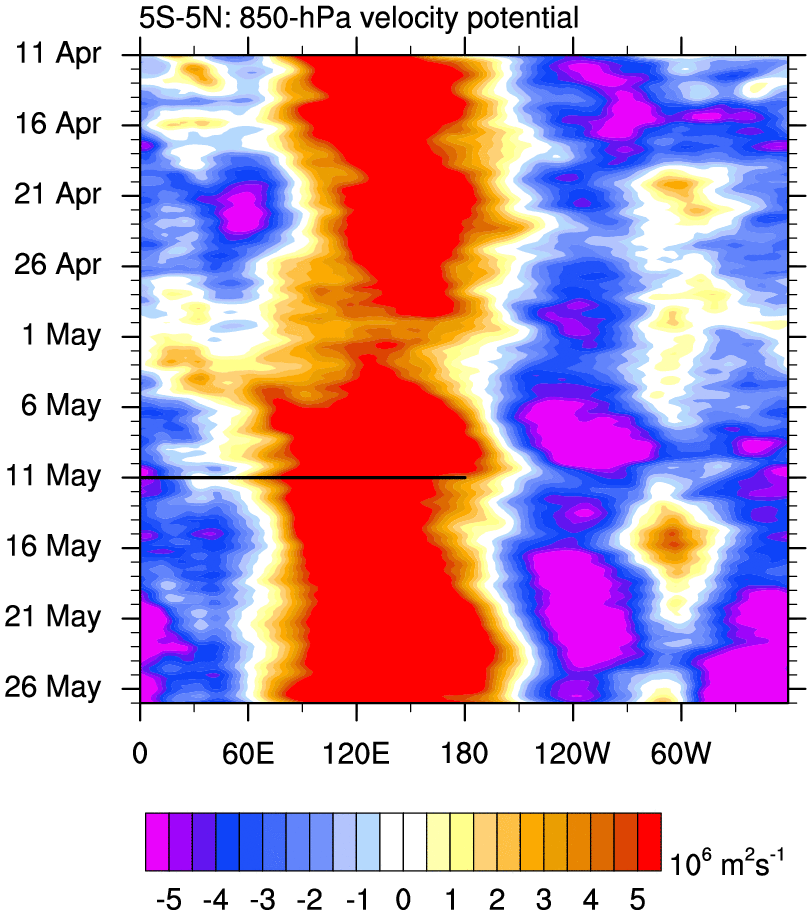
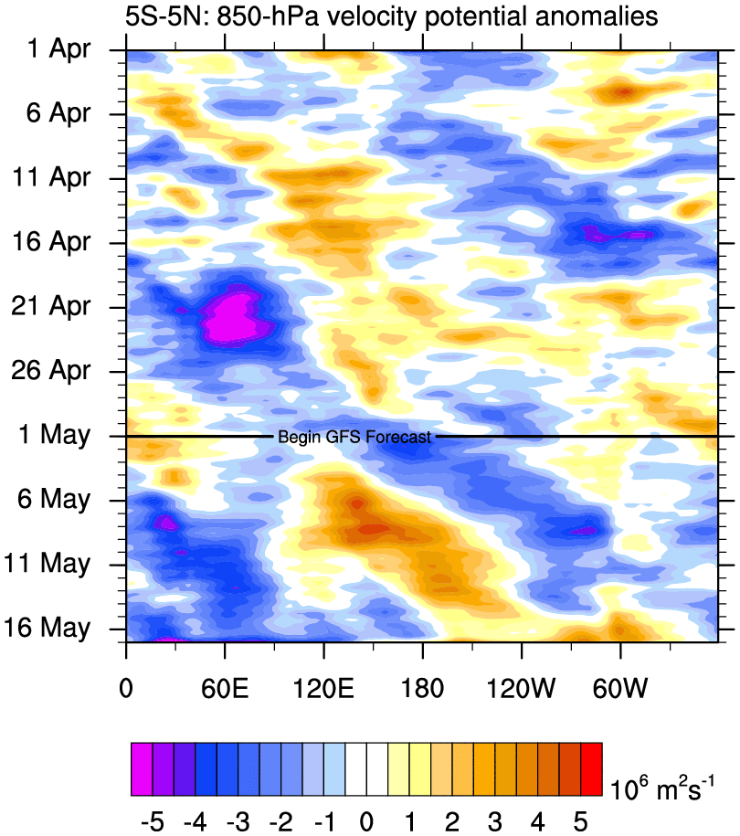
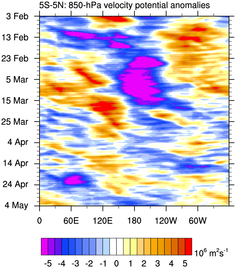
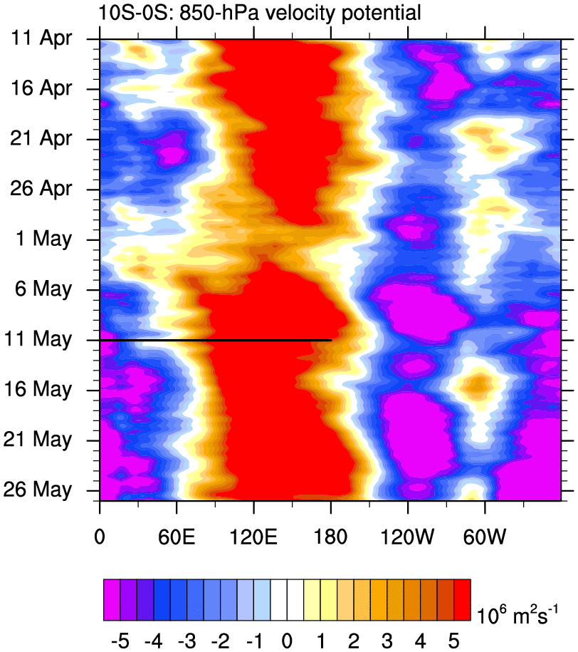
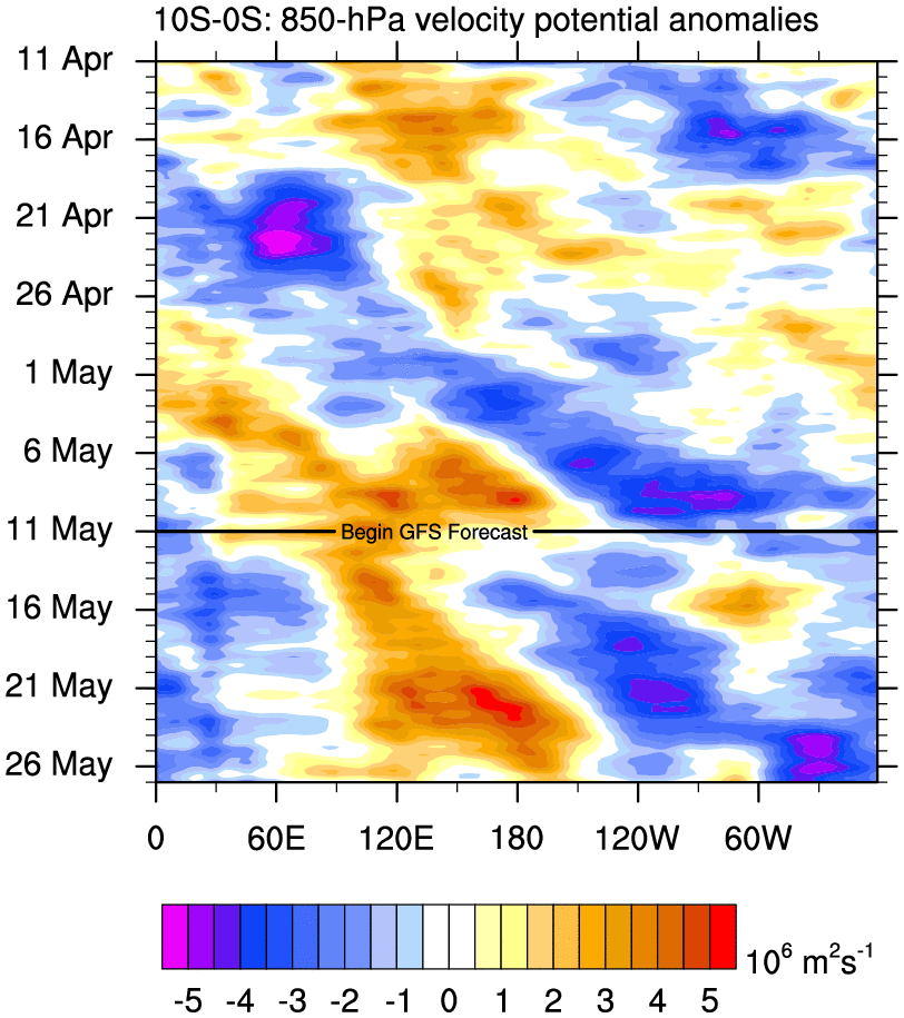
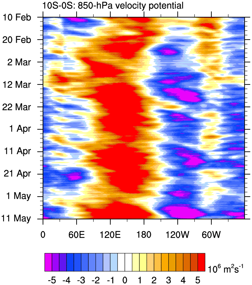
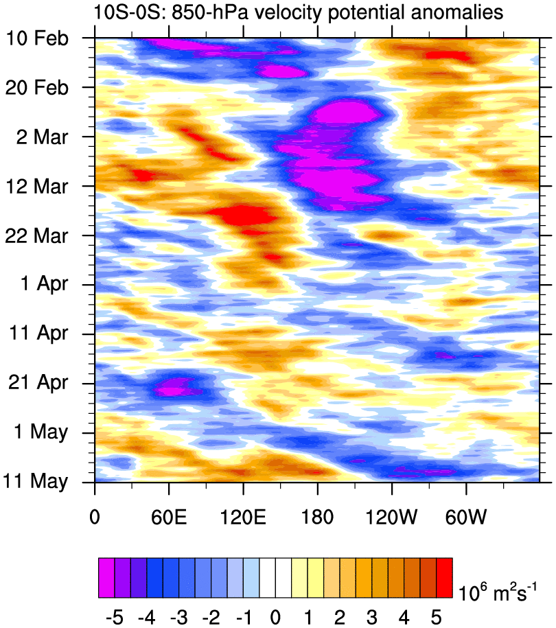
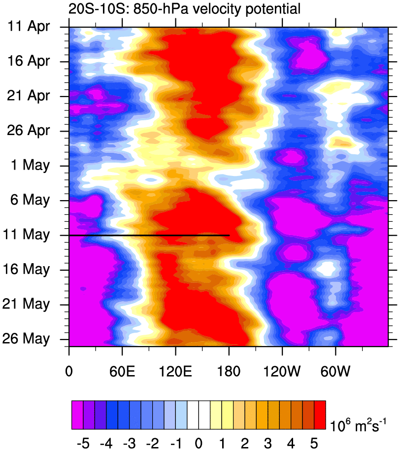
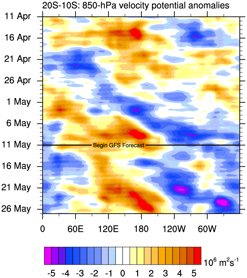
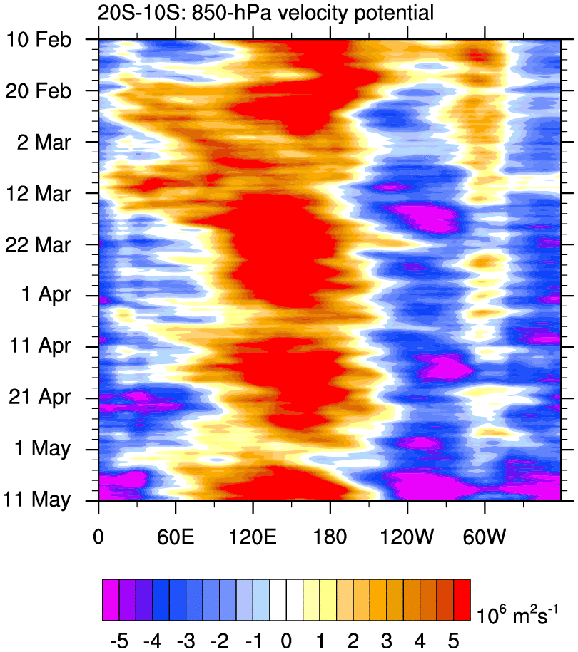
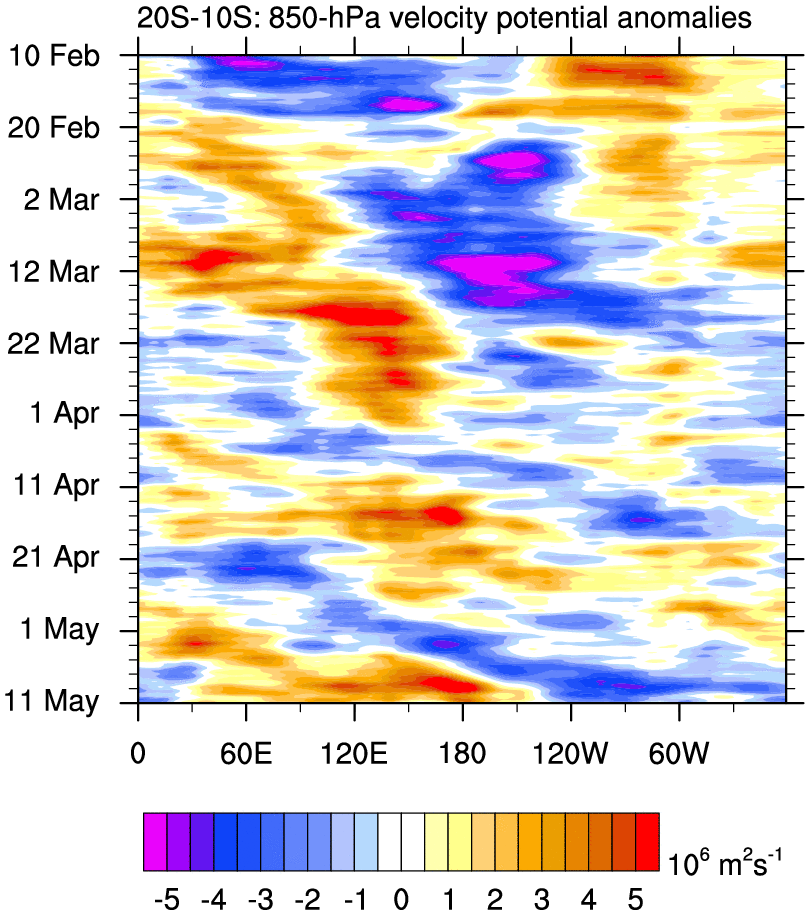
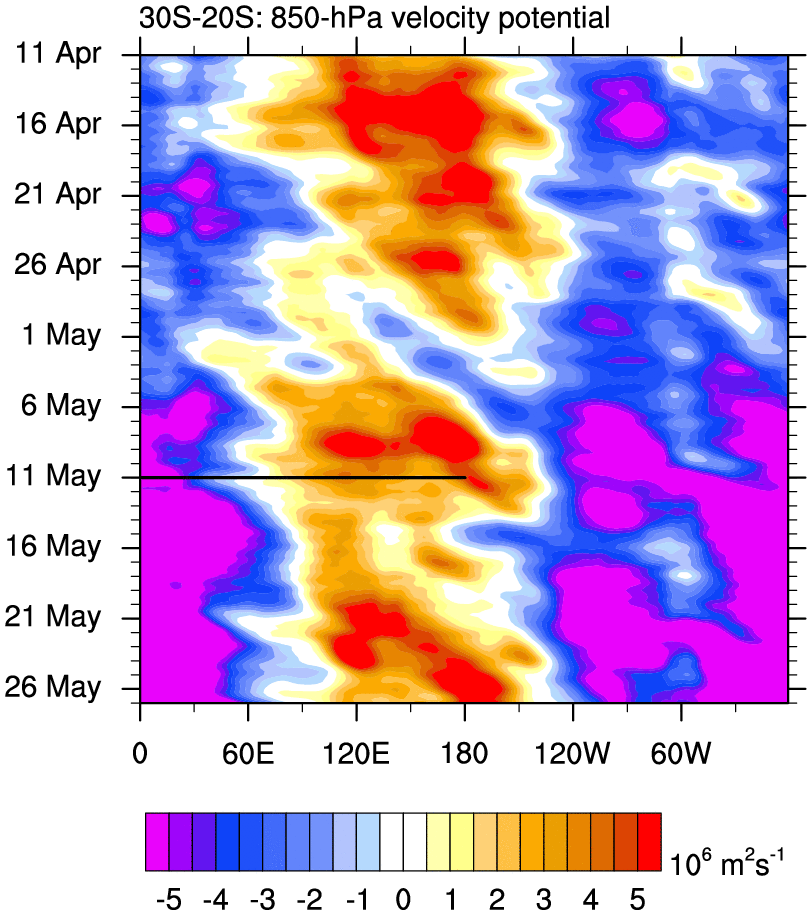
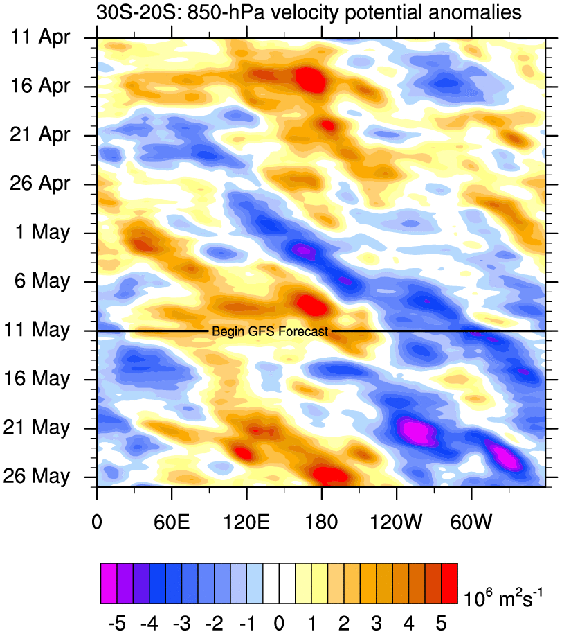
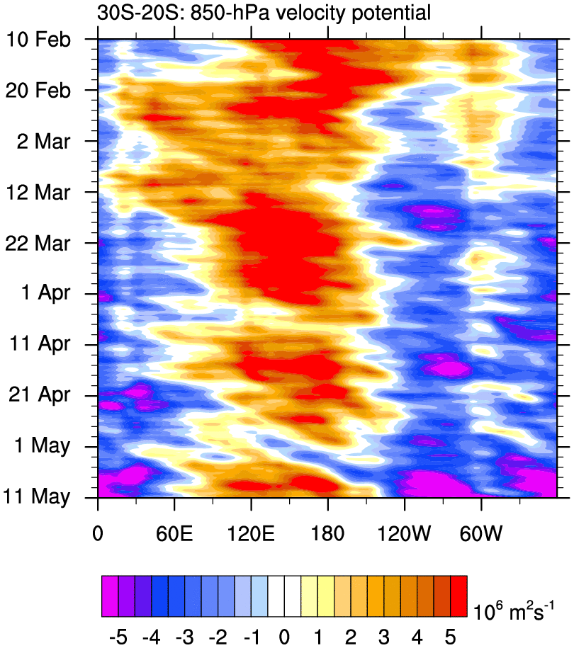
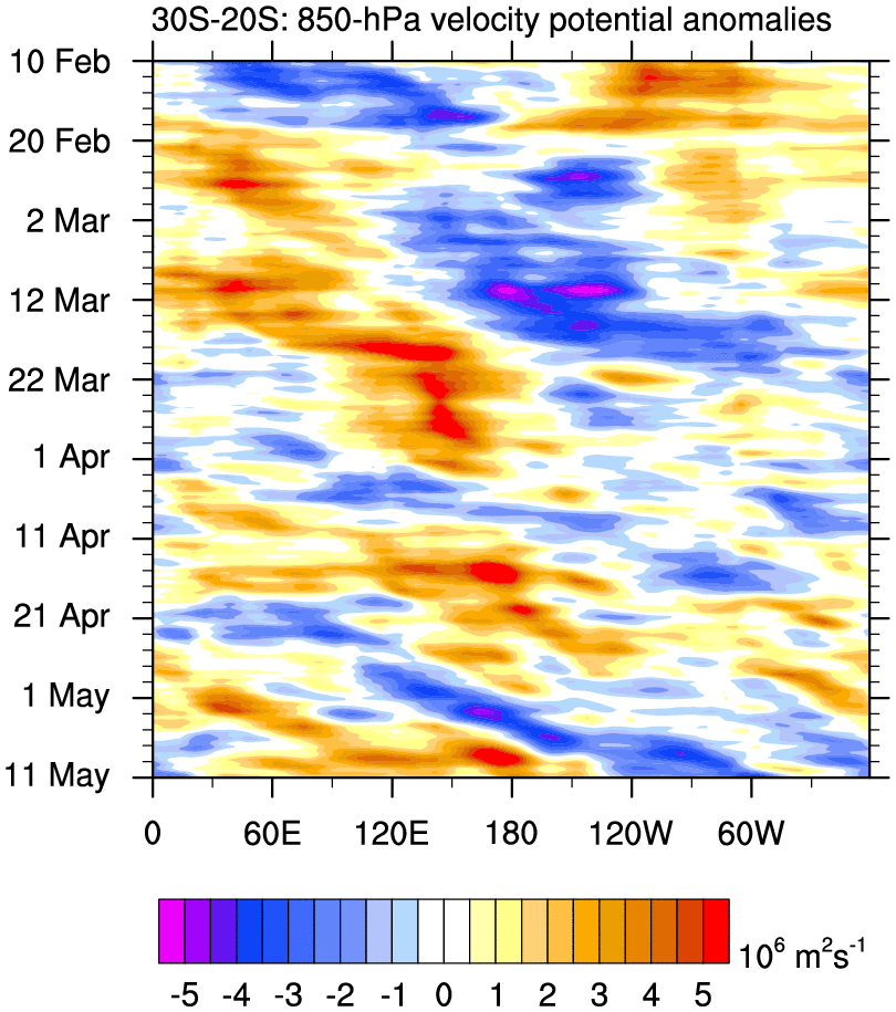
850 hPa Global Velocity Potential Time–Longitude Plots
o Time–longitude plots of velocity potential for each region, averaged over the indicated latitude bands
o GFS forecast attached to 30 Day plots
30 Day 90 Day
20°N – 30°N total anom total anom
10°N – 20°N total anom total anom
Eq – 10°N total anom total anom
5°S – 5°N total anom total anom
10°S – Eq total anom total anom
20°S – 10°S total anom total anom
30°S – 20°S total anom total anom
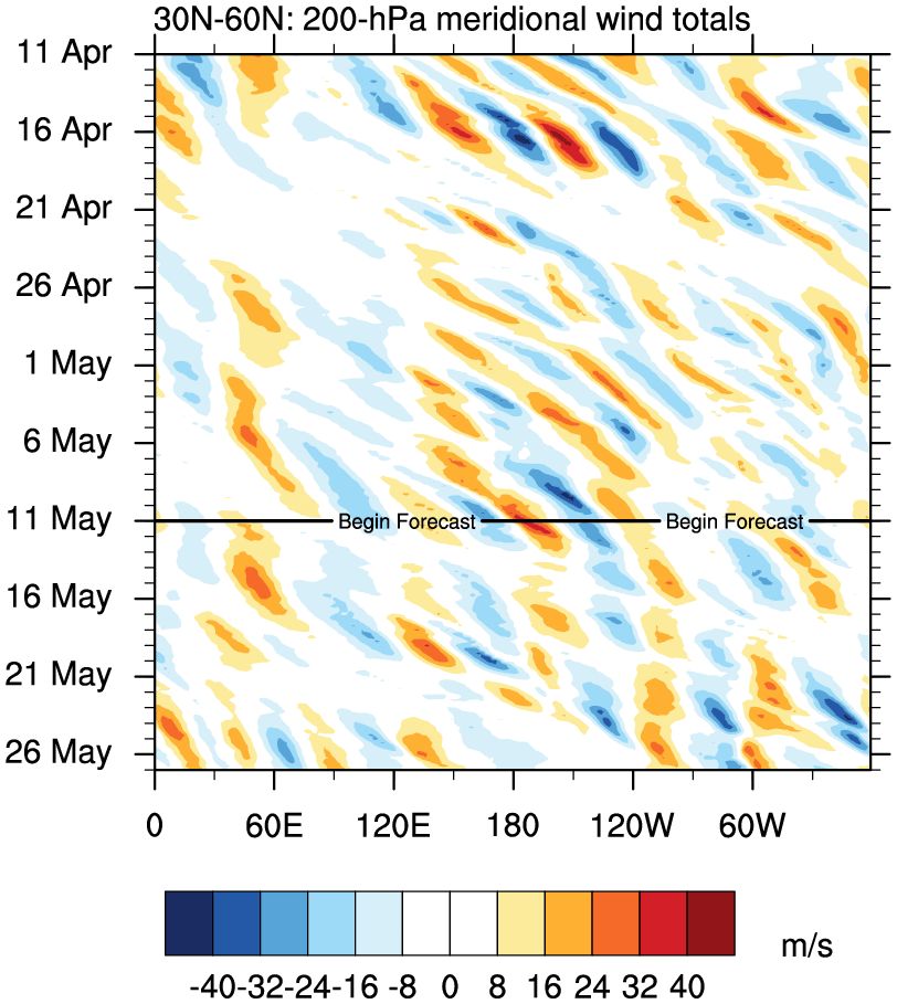
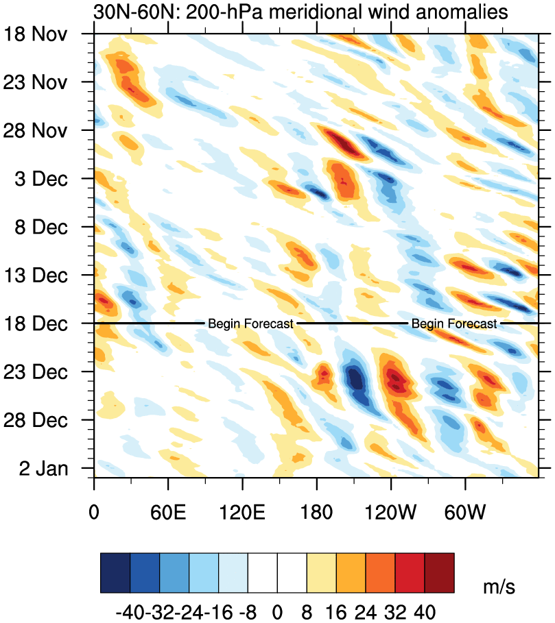
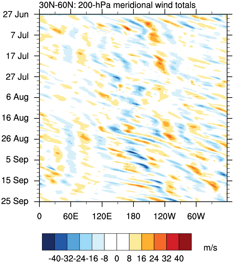
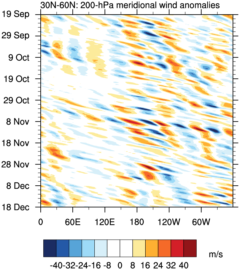
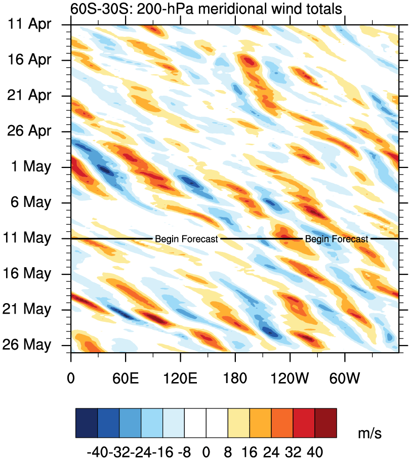
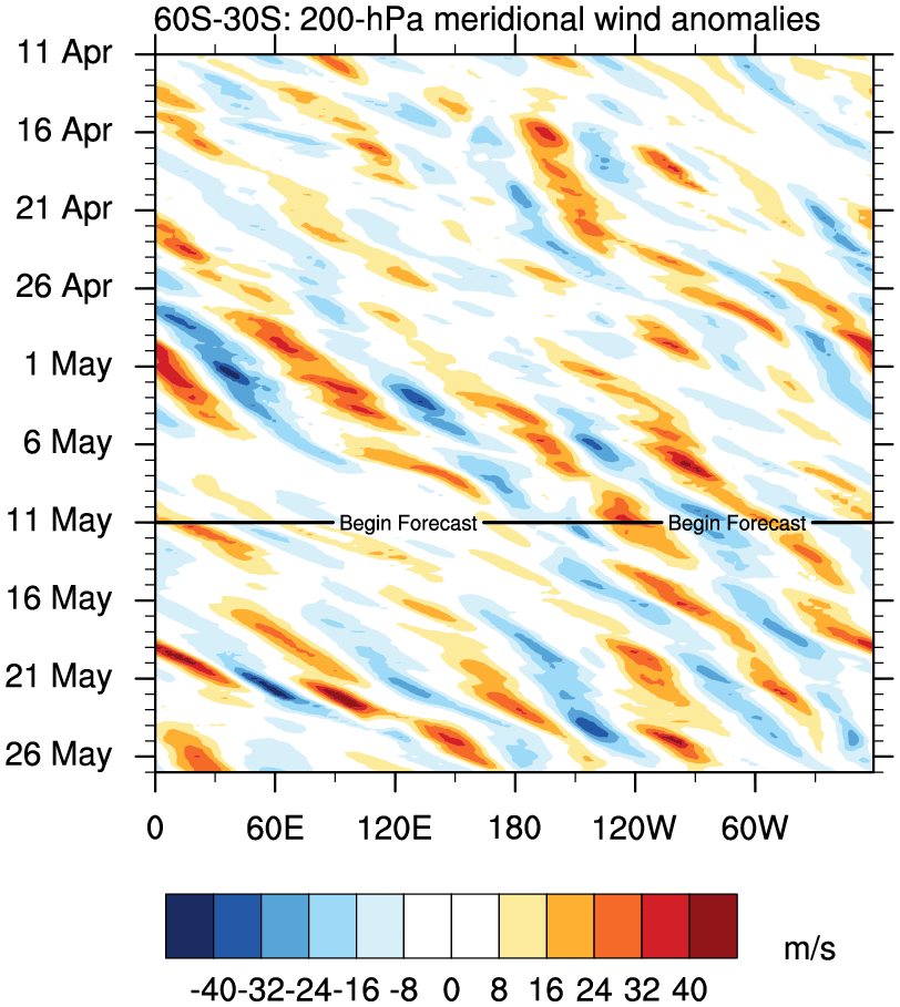
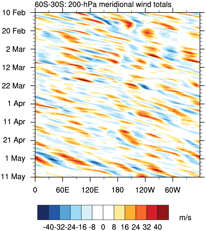
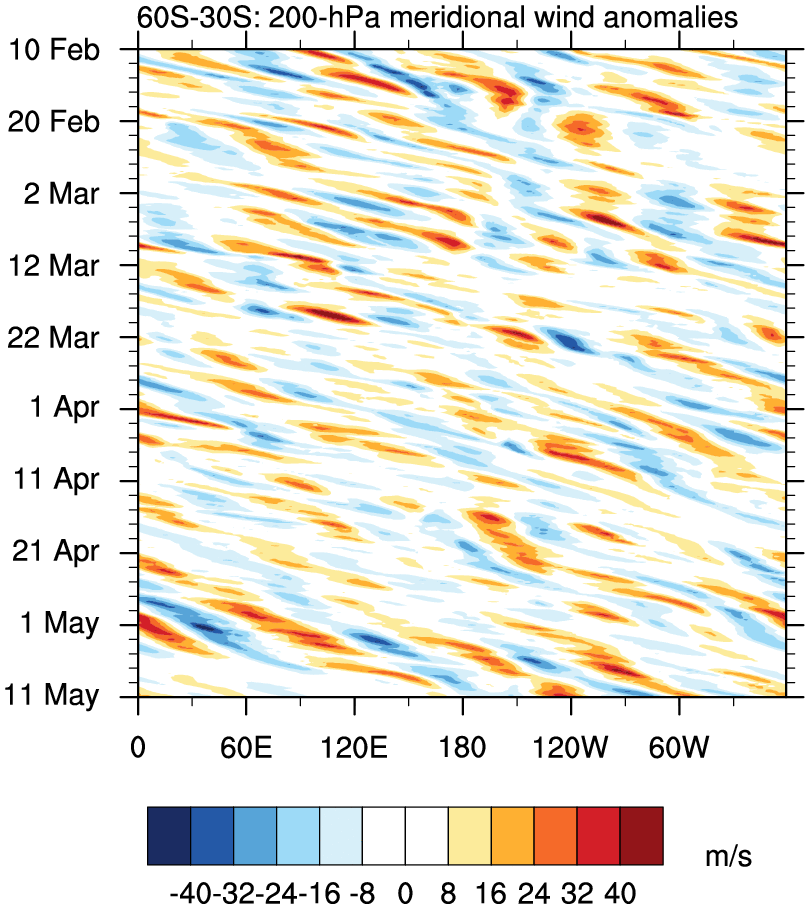
200 hPa Meridional Wind: Extra-tropical wave trains
o Time–longitude plots of meridional wind for both hemispheres, averaged over the indicated latitude bands
o GFS forecast attached to 30 Day plots
30 Day 90 Day
30°N – 60°N total anom total anom
30°S – 60°S total anom total anom
o The precipitation data comes from the real-time version of NASA’s TRMM multisatellite precipitation analysis (TMPA, TRMM product 3B42RT).
o Forecast data and 850-hPa wind analyses come from NCEP’s GFS model.
o Anomalies are calculated by subtracting the first four harmonics of the annual cycle. The annual cycle for precipitation is calculated from the research on of the NASA TRMM 3B42 (1998–2008), and the cycle for 850-hPa winds are calculated from ERA-interim reanalyses (1989–2008).
o All plots are made using NCAR Command Language (NCL).
o This website is supported by funding from the NASA Grant NNX09AD08G.
o Wind plots use 1° GFS analyses for the last 90 days
o Updated daily at 1200 UTC
850 hPa Meridional Wind
20°N – 30°N total anom
10°N – 20°N total anom
Eq – 10°N total anom
5°S – 5°N total anom
10°S – Eq total anom
20°S – 10°S total anom
30°S – 20°S total anom
850 hPa Global Zonal Wind Time–Longitude Plots
o Time–longitude plots of 850 hPa U for each region, averaged over the indicated latitude bands
o GFS forecast attached to 30 Day plots
30 Day 90 Day
20°N – 30°N total anom total anom
10°N – 20°N total anom total anom
Eq – 10°N total anom total anom
5°S – 5°N total anom total anom
10°S – Eq total anom total anom
20°S – 10°S total anom total anom
30°S – 20°S total anom total anom
200 hPa Global Zonal Wind Time–Longitude Plots
o Time–longitude plots of 200 hPa U for each region, averaged over the indicated latitude bands
o GFS forecast attached to 30 Day plots
30 Day 90 Day
20°N – 30°N total anom total anom
10°N – 20°N total anom total anom
Eq – 10°N total anom total anom
5°S – 5°N total anom total anom
10°S – Eq total anom total anom
20°S – 10°S total anom total anom
30°S – 20°S total anom total anom
200 hPa Global Velocity Potential Time–Longitude Plots
o Time–longitude plots of velocity potential for each region, averaged over the indicated latitude bands
o GFS forecast attached to 30 Day plots
30 Day 90 Day
20°N – 30°N total anom total anom
10°N – 20°N total anom total anom
Eq – 10°N total anom total anom
5°S – 5°N total anom total anom
10°S – Eq total anom total anom
20°S – 10°S total anom total anom
30°S – 20°S total anom total anom
850 hPa Global Velocity Potential Time–Longitude Plots
o Time–longitude plots of velocity potential for each region, averaged over the indicated latitude bands
o GFS forecast attached to 30 Day plots
30 Day 90 Day
20°N – 30°N total anom total anom
10°N – 20°N total anom total anom
Eq – 10°N total anom total anom
5°S – 5°N total anom total anom
10°S – Eq total anom total anom
20°S – 10°S total anom total anom
30°S – 20°S total anom total anom
200 hPa Meridional Wind: Extra-tropical wave trains
o Time–longitude plots of meridional wind for both hemispheres, averaged over the indicated latitude bands
o GFS forecast attached to 30 Day plots
30 Day 90 Day
30°N – 60°N total anom total anom
30°S – 60°S total anom total anom
o The precipitation data comes from the real-time version of NASA’s TRMM multisatellite precipitation analysis (TMPA, TRMM product 3B42RT).
o Forecast data and 850-hPa wind analyses come from NCEP’s GFS model.
o Anomalies are calculated by subtracting the first four harmonics of the annual cycle. The annual cycle for precipitation is calculated from the research on of the NASA TRMM 3B42 (1998–2008), and the cycle for 850-hPa winds are calculated from ERA-interim reanalyses (1989–2008).
o All plots are made using NCAR Command Language (NCL).
o This website is supported by funding from the NASA Grant NNX09AD08G.
